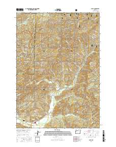
2017 Map of Alsea
USGS Topo · Published 2017About this map
Alsea sits at the heart of this coastal range landscape, where the Alsea River and its numerous tributaries carve through the timberlands of the Siuslaw National Forest. The geography is defined by significant elevations such as Marys Peak and Old Blue Mtn, overlooking the agricultural opening of Alsea Valley. Local genealogy and land use are centered around the Alsea Cem and family-named landmarks like Maddsens Knob. The map traces a complex network of forest access roads, including BLM RD 10 and Marys Peak Rd, reflecting the region's long-standing reliance on the logging industry and resource management. Natural water sources like Cathcart Springs and the N Fork Alsea River underscore the importance of the river system to the valley's settlement pattern and development.
Find a feature on this map
55 named features on this map. Tap any name to fly to it.
Don’t see what you’re looking for? This feature index may not catch every label — zoom into the map to look around manually.
Map Details
Editions of this 2017 Alsea Map
This is the sole edition of this map. No revisions or reprints were ever made.
Other maps of this area

1921 · Corvallis
USGS Topo · 1:62,500

1922 · Monroe
USGS Topo · 1:62,500

1939 · Marys Peak
USGS Topo · 1:62,500

1939 · Monroe
USGS Topo · 1:62,500

1942 · Marys Peak
USGS Topo · 1:62,500

1942 · Alsea
USGS Topo · 1:62,500

1942 · Monroe
USGS Topo · 1:62,500

1942 · Corvallis
USGS Topo · 1:62,500

1953 · Salem
USGS Topo · 1:250,000

1954 · Salem
USGS Topo · 1:250,000