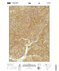
2020 Map of Alsea
USGS Topo · Published 2020About this map
The community of Alsea sits at the confluence of several vital waterways in the central Coast Range, serving as a gateway to the dense timberlands of the Siuslaw National Forest. This 2020 topographic record highlights the complex drainage system feeding the Alsea River, including the North Fork Alsea River and the N Fork Alsea River. The geography is defined by prominent peaks and ridges such as Old Blue Mtn, Doe Mtn, and Easter Ridge, which hem in the fertile Alsea Valley. Local genealogy and land use are anchored by sites like the Alsea Cem and Cathcart Springs, while the mountain passes are marked by Alsea Summit and Maddsens Knob. The map traces the winding paths of Honey Grove Rd and Seeley Creek Rd, which provide access to the remote drainages of Honey Grove Cr and Seeley Cr.
Find a feature on this map
54 named features on this map. Tap any name to fly to it.
Don’t see what you’re looking for? This feature index may not catch every label — zoom into the map to look around manually.
Map Details
Editions of this 2020 Alsea Map
This is the sole edition of this map. No revisions or reprints were ever made.
Other maps of this area

1921 · Corvallis
USGS Topo · 1:62,500

1922 · Monroe
USGS Topo · 1:62,500

1939 · Marys Peak
USGS Topo · 1:62,500

1939 · Monroe
USGS Topo · 1:62,500

1942 · Marys Peak
USGS Topo · 1:62,500

1942 · Alsea
USGS Topo · 1:62,500

1942 · Monroe
USGS Topo · 1:62,500

1942 · Corvallis
USGS Topo · 1:62,500

1953 · Salem
USGS Topo · 1:250,000

1954 · Salem
USGS Topo · 1:250,000