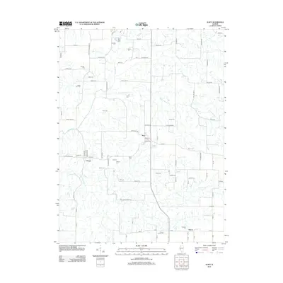
2012 Map of Alsey
USGS Topo · Published 2012About this map
The small settlements of Alsey, Glasgow, and Barrow define this central Illinois landscape, clustered around a network of creek drainages including Big Sandy Cr and N Little Sandy Cr. The geography is notable for its unusually high density of family and community burial grounds, which serve as a primary record of the area's rural history. Genealogical landmarks are found across the townships, from the Cowhick Cem and Perkins Cem in the north to the Thompson Cem and Williams Edwards Cem near Barrow. The village of Glasgow is clearly delineated with its street grid, featuring W Main St and Market St, while nearby Alsey Lake and several smaller water bodies punctuate the agricultural terrain. This survey provides a precise look at the 2012 infrastructure, showing the connections between these established communities via roads like the Winchester Glasgow Rd.
Find a feature on this map
70 named features on this map. Tap any name to fly to it.
Don’t see what you’re looking for? This feature index may not catch every label — zoom into the map to look around manually.
Map Details
Editions of this 2012 Alsey Map
This is the sole edition of this map. No revisions or reprints were ever made.
Other maps of this area

1924 · Winchester
USGS Topo · 1:48,000

1924 · Roodhouse
USGS Topo · 1:62,500

1924 · Griggsville
USGS Topo · 1:62,500

1926 · Griggsville
USGS Topo · 1:62,500

1926 · Winchester
USGS Topo · 1:62,500

1926 · Roodhouse
USGS Topo · 1:62,500

1930 · Pearl
USGS Topo · 1:62,500

1948 · Quincy
USGS Topo · 1:250,000

1950 · Pearl
USGS Topo · 1:62,500

1956 · Quincy
USGS Topo · 1:250,000