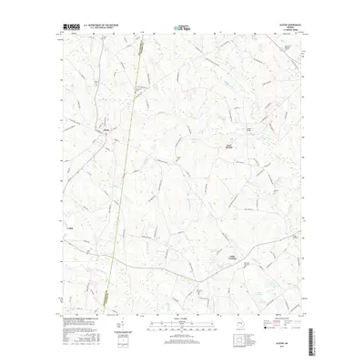
2017 Map of Alston
USGS Topo · Published 2017About this map
Alston and Uvalda anchor the western portion of this 2017 survey, where the border between Montgomery Co and Toombs Co cuts through a landscape of drainage basins and family-named cemeteries. The terrain is defined by a complex network of waterways, including the winding Oconee Cr to the north and the extensive systems of Alligator Cr and Little Alligator Cr in the south. These creeks converge and feed into larger features like Upper Cato Lake and Lower Cato Lake near the southeastern corner.
Find a feature on this map
99 named features on this map. Tap any name to fly to it.
Don’t see what you’re looking for? This feature index may not catch every label — zoom into the map to look around manually.
Map Details
Editions of this 2017 Alston Map
This is the sole edition of this map. No revisions or reprints were ever made.
Other maps of this area

1953 · Waycross
USGS Topo · 1:250,000

1957 · Macon
USGS Topo · 1:250,000

1958 · Macon
USGS Topo · 1:250,000

1958 · Waycross
USGS Topo · 1:250,000

1964 · Macon
USGS Topo · 1:250,000

1970 · Johnson Corner
USGS Topo · 1:24,000

1970 · Alston
USGS Topo · 1:24,000

1970 · Mount Vernon
USGS Topo · 1:24,000

1970 · Vidalia
USGS Topo · 1:24,000

1970 · Uvalda
USGS Topo · 1:24,000