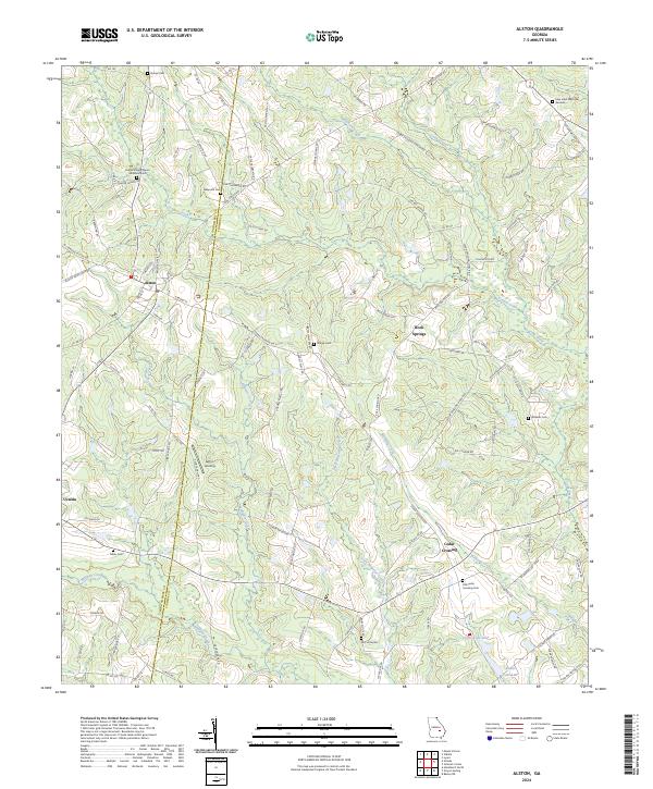
2024 Map of Alston
USGS Topo · Published 2024About this map
Alston and Uvalda anchor this portion of the Georgia coastal plain, where the landscape is defined by the winding paths of Alligator Creek and Williams Creek. The boundary between Montgomery Co and Toombs Co runs vertically through the center of the sheet, dividing agricultural tracts and timberlands. Genealogists will find a significant number of family and community burial grounds, including Sharpe Cem, Galbreath Cem, and the Old Cedar Crossing Cem. To the south, the terrain descends toward the water at Upper Cato Lake and Lower Cato Lake, while Lefty's Landing provides a specific point of access to the local hydrology. The network of county roads, such as Cedar Crossing Vidalia Rd, connects smaller communities like Cedar Crossing and Rock Springs, reflecting the rural settlement patterns that persist into the 2020s.
Find a feature on this map
102 named features on this map. Tap any name to fly to it.
Don’t see what you’re looking for? This feature index may not catch every label — zoom into the map to look around manually.
Map Details
Editions of this 2024 Alston Map
This is the sole edition of this map. No revisions or reprints were ever made.
Other maps of this area

1953 · Waycross
USGS Topo · 1:250,000

1957 · Macon
USGS Topo · 1:250,000

1958 · Macon
USGS Topo · 1:250,000

1958 · Waycross
USGS Topo · 1:250,000

1964 · Macon
USGS Topo · 1:250,000

1970 · Johnson Corner
USGS Topo · 1:24,000

1970 · Alston
USGS Topo · 1:24,000

1970 · Mount Vernon
USGS Topo · 1:24,000

1970 · Vidalia
USGS Topo · 1:24,000

1970 · Uvalda
USGS Topo · 1:24,000