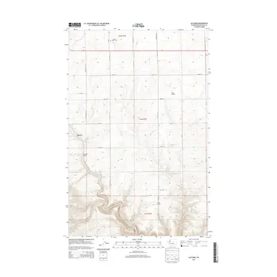
2014 Map of Alstown
USGS Topo · Published 2014About this map
Alstown sits at the edge of a high plateau in Douglas County, where the landscape is defined by the dramatic descent of the coulees into the Douglas Cr drainage. This 2014 survey captures a rural agricultural region crisscrossed by a grid of numbered section roads, such as Road 1 SW and Road 4 SW, which navigate the wheat fields and canyon rims. The land's history is anchored by modest community markers, including the Douglas Luthern Cem in the north and the Slack Cem located further south near Slack Canyon. These features, along with the proximity of Us-2, illustrate the enduring layout of the Big Bend country's transportation and settlement patterns. The map detail highlights the stark transition from the level agricultural uplands into deeply carved geological features like Titchenal Canyon and Mohr Canyon.
Find a feature on this map
30 named features on this map. Tap any name to fly to it.
Don’t see what you’re looking for? This feature index may not catch every label — zoom into the map to look around manually.
Map Details
Editions of this 2014 Alstown Map
This is the sole edition of this map. No revisions or reprints were ever made.
Other maps of this area

1901 · Chelan
USGS Topo · 1:125,000

1912 · Malaga
USGS Topo · 1:48,000

1914 · Malaga
USGS Topo · 1:62,500

1920 · Colockum Pass
USGS Topo · 1:125,000

1922 · Colockum Pass
USGS Topo · 1:125,000

1953 · Ritzville
USGS Topo · 1:250,000

1957 · Wenatchee
USGS Topo · 1:250,000

1959 · Ritzville
USGS Topo · 1:250,000

1965 · Ritzville
USGS Topo · 1:250,000
1966 · Palisades
USGS Topo · 1:24,000