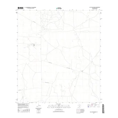
2016 Map of Alta Vista Ranch
USGS Topo · Published 2016About this map
Alta Vista Ranch and the surrounding rangelands of Jim Hogg County define this portion of the South Texas landscape as it appeared in the mid-2010s. The area is characterized by a network of ranching roads and infrastructure, including the Puesta Del Sol Airport located near Kaffie Ranch Rd. Transportation across this sparse terrain is facilitated by FM 1017, which serves as a primary north-south artery connecting various private holdings. The naming of local thoroughfares like Kelly Oil Rd and Las Cuatas Ranch Rd reflects the long-standing intersection of livestock ranching and energy extraction in the region. This survey captures the rural layout of large Texas estates, showing how fence lines and dirt tracks such as La Lumbrita Rd organize the brush country.
Find a feature on this map
8 named features on this map. Tap any name to fly to it.
Don’t see what you’re looking for? This feature index may not catch every label — zoom into the map to look around manually.
Map Details
Editions of this 2016 Alta Vista Ranch Map
This is the sole edition of this map. No revisions or reprints were ever made.
Other maps of this area

1921 · Falfurrias
USGS Topo · 1:125,000

1938 · Agua Nueva
USGS Topo · 1:62,500

1939 · Encantada
USGS Topo · 1:62,500

1949 · Mc Allen
USGS Topo · 1:250,000

1954 · McAllen
USGS Topo · 1:250,000

1956 · Laredo
USGS Topo · 1:250,000

1957 · Mc Allen
USGS Topo · 1:250,000

1962 · McAllen
USGS Topo · 1:250,000

1968 · Palomas Ranch NW
USGS Topo · 1:24,000

1968 · Palomas Ranch SW
USGS Topo · 1:24,000