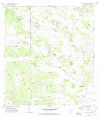
1972 Map of Alta Vista Ranch
USGS Topo · Published 1975About this map
Alta Vista Ranch and several neighboring family-owned spreads define this section of Jim Hogg County during the early 1970s. The landscape is characterized by a sparse, ranching-based settlement pattern where water is the most critical resource. The sheer density of named windmills, such as Mala Suerte Windmill, Cinco de Mayo Windmill, and Posito Cerca Windmill, highlights the infrastructure required to sustain livestock in this semi-arid South Texas environment. Beyond agriculture, the map documents early industrial incursions into the brush country, with several Oil Wells and numerous exploratory Drill Holes scattered across the ranch lands. This 1972 survey also preserves the locations of established ranch headquarters, including Kaffie Ranch and Las Cuatas Ranch, which served as the primary hubs for local residents and genealogy researchers tracing South Texas land use.
Find a feature on this map
36 named features on this map. Tap any name to fly to it.
Don’t see what you’re looking for? This feature index may not catch every label — zoom into the map to look around manually.
Map Details
Editions of this 1972 Alta Vista Ranch Map
This is the sole edition of this map. No revisions or reprints were ever made.
Other maps of this area

1921 · Falfurrias
USGS Topo · 1:125,000

1938 · Agua Nueva
USGS Topo · 1:62,500

1939 · Encantada
USGS Topo · 1:62,500

1949 · Mc Allen
USGS Topo · 1:250,000

1954 · McAllen
USGS Topo · 1:250,000

1956 · Laredo
USGS Topo · 1:250,000

1957 · Mc Allen
USGS Topo · 1:250,000

1962 · McAllen
USGS Topo · 1:250,000

1968 · Palomas Ranch NW
USGS Topo · 1:24,000

1968 · Palomas Ranch SW
USGS Topo · 1:24,000