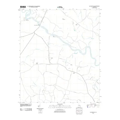
2011 Map of Altamaha SE
USGS Topo · Published 2011About this map
The Altamaha River winds through this coastal plain landscape, defining a region where water and bottomland geography have long dictated local movement. River access points like Carters Bight Landing and Lower Sister Bluff Landing highlight the historic importance of the river as a transportation corridor. The John C Beasley Memorial Bridge provides the primary crossing point, connecting the southern road network to the northern banks. Inland, the distribution of family-named burial grounds, including the Moody-Tillman Cemetery, Thompson Cemetery, and Warren Cemetery, suggests a deeply rooted rural community organized around family landholdings and small local roads like Quinn Rd and Friendship Church Rd. The landscape is further characterized by numerous water bodies such as Watermelon Creek and the seasonally isolated Rocky Lake.
Find a feature on this map
43 named features on this map. Tap any name to fly to it.
Don’t see what you’re looking for? This feature index may not catch every label — zoom into the map to look around manually.
Map Details
Editions of this 2011 Altamaha SE Map
This is the sole edition of this map. No revisions or reprints were ever made.
Other maps of this area

1918 · Jesup
USGS Topo · 1:62,500

1920 · Glennville
USGS Topo · 1:62,500

1943 · Jesup
USGS Topo · 1:62,500

1944 · Glennville
USGS Topo · 1:62,500

1946 · Brunswick
USGS Topo · 1:250,000

1948 · Brunswick
USGS Topo · 1:250,000

1950 · Glennville
USGS Topo · 1:62,500

1953 · Waycross
USGS Topo · 1:250,000

1956 · Brunswick
USGS Topo · 1:250,000

1958 · Waycross
USGS Topo · 1:250,000