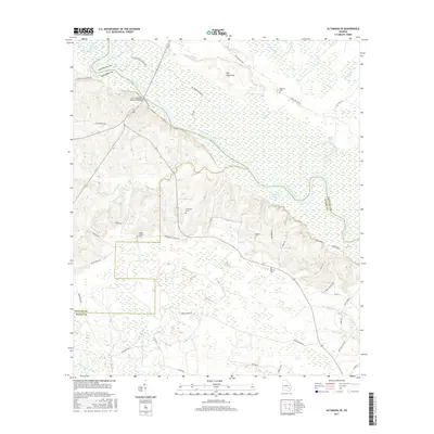
2017 Map of Altamaha SE
USGS Topo · Published 2017About this map
The Altamaha River winds through this Georgia landscape, defining the convergence of Tattnall, Appling, and Wayne counties. The river's path is marked by substantial bottomlands such as Big Hammock and a network of oxbows and backwaters including Bluff Lake, Jessie Lake, and Rocky Lake. Access to the water is centered on the John C Beasley Memorial Bridge and historically significant river points like Carter Bight Landing Rd and Je Stanfield Landing Rd. Away from the riverbanks, the terrain transitions into upland areas where family-named cemeteries such as the Moody-Tillman Cem, O'Quinn Cem, and Thompson Cem are preserved among a grid of rural routes. These burial sites and landings provide a clear record of the settlement patterns and river-dependent lifeways that have persisted in this corner of Georgia.
Find a feature on this map
50 named features on this map. Tap any name to fly to it.
Don’t see what you’re looking for? This feature index may not catch every label — zoom into the map to look around manually.
Map Details
Editions of this 2017 Altamaha SE Map
This is the sole edition of this map. No revisions or reprints were ever made.
Other maps of this area

1918 · Jesup
USGS Topo · 1:62,500

1920 · Glennville
USGS Topo · 1:62,500

1943 · Jesup
USGS Topo · 1:62,500

1944 · Glennville
USGS Topo · 1:62,500

1946 · Brunswick
USGS Topo · 1:250,000

1948 · Brunswick
USGS Topo · 1:250,000

1950 · Glennville
USGS Topo · 1:62,500

1953 · Waycross
USGS Topo · 1:250,000

1956 · Brunswick
USGS Topo · 1:250,000

1958 · Waycross
USGS Topo · 1:250,000