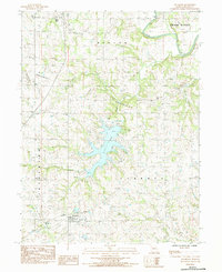
1984 Map of Altamont
USGS Topo · Published 1984About this map
The sprawling waters of Lake Viking dominate the central landscape of this Missouri quadrangle, a significant man-made reservoir characterized by its many fingers and inlets. To the south, the village of Altamont sits along the Old Railroad Grade, reflecting the region's historical reliance on rail transport before the transition to modern highway networks. The settlement of Civil Bend is located in the north, surrounded by several family and community burial sites including Civil Bend Cem and Civil Bend Christian Cem.
Find a feature on this map
30 named features on this map. Tap any name to fly to it.
Don’t see what you’re looking for? This feature index may not catch every label — zoom into the map to look around manually.
Map Details
Editions of this 1984 Altamont Map
This is the sole edition of this map. No revisions or reprints were ever made.
Other maps of this area

1922 · Gallatin
USGS Topo · 1:62,500

1924 · Winston
USGS Topo · 1:62,500

1925 · Pattonsburg
USGS Topo · 1:62,500

1925 · Gilman
USGS Topo · 1:62,500

1944 · Pattonsburg
USGS Topo · 1:62,500

1946 · Gilman
USGS Topo · 1:48,000

1946 · Pattonsburg
USGS Topo · 1:48,000

1948 · Gilman
USGS Topo · 1:62,500

1948 · Pattonsburg
USGS Topo · 1:62,500

1950 · Kansas City
USGS Topo · 1:250,000