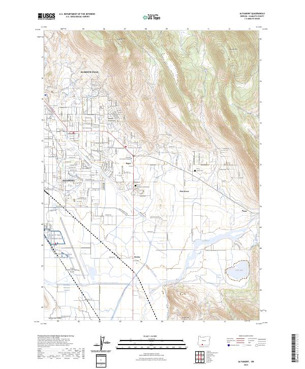
2024 Map of Altamont
USGS Topo · Published 2024About this map
The southern outskirts of Klamath Falls and the residential core of Altamont define this area of the High Desert, where urban development meets a complex network of agricultural irrigation. The landscape is heavily influenced by water management, featuring an intricate system of canals including the A Canal, B Canal, and the Lost River Diversion Channel. These man-made waterways cut through the terrain alongside the natural path of the Lost River, supporting the surrounding valleys.
Find a feature on this map
132 named features on this map. Tap any name to fly to it.
Don’t see what you’re looking for? This feature index may not catch every label — zoom into the map to look around manually.
Map Details
Editions of this 2024 Altamont Map
This is the sole edition of this map. No revisions or reprints were ever made.
Other maps of this area

1889 · Klamath
USGS Topo · 1:250,000

1894 · Klamath
USGS Topo · 1:250,000

1955 · Klamath Falls
USGS Topo · 1:250,000

1957 · Merrill
USGS Topo · 1:62,500

1957 · Swan Lake
USGS Topo · 1:62,500

1957 · Klamath Falls
USGS Topo · 1:62,500

1957 · Modoc Point
USGS Topo · 1:62,500

1958 · Klamath Falls
USGS Topo · 1:250,000
1975 · Klamath Falls NE
USGS Topo · 1:24,000

1975 · Merrill NW
USGS Topo · 1:24,000