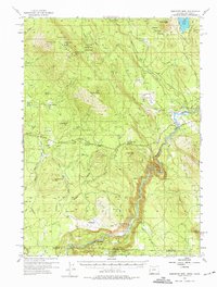
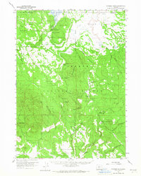
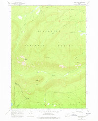
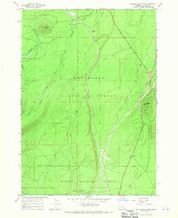
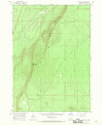
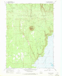
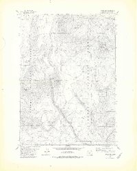
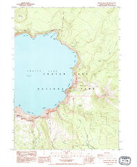
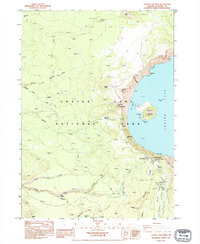
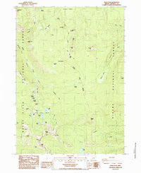
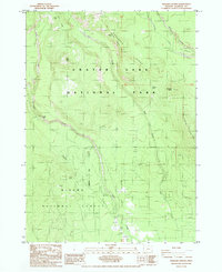
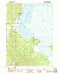
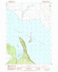
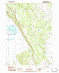
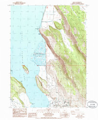
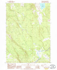
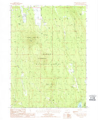
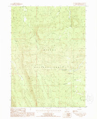
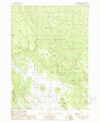
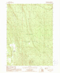
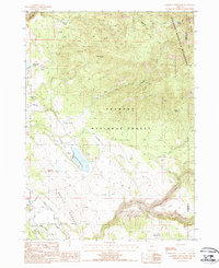
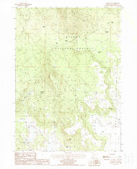
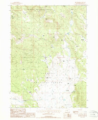
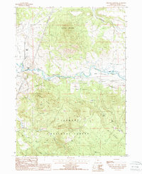
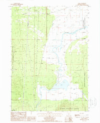
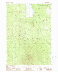
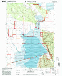
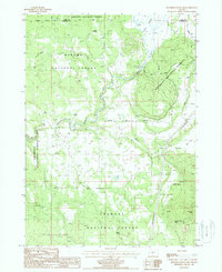
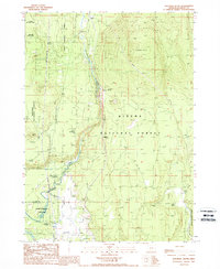
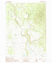
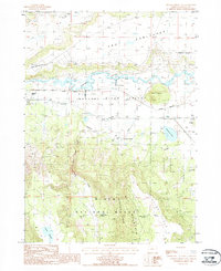
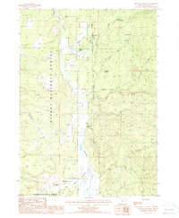
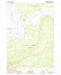
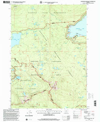
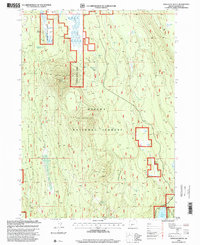
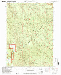
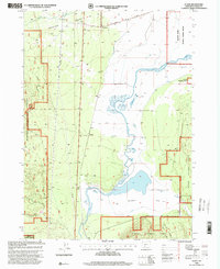
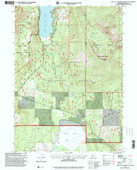
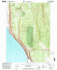
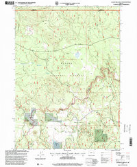
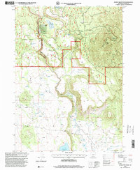
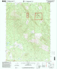
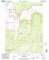
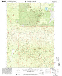
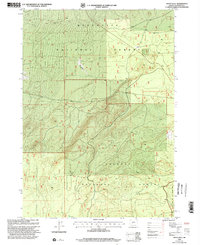
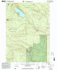
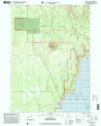
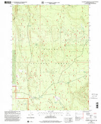
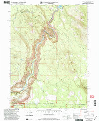
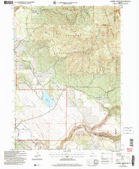
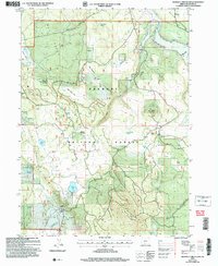
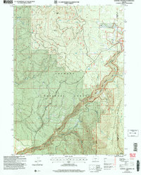
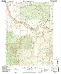
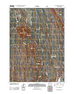
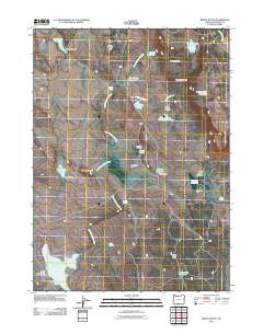
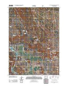
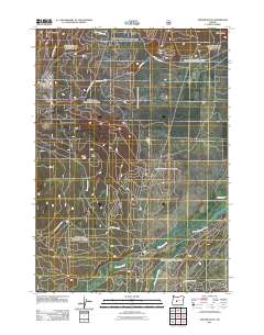
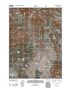
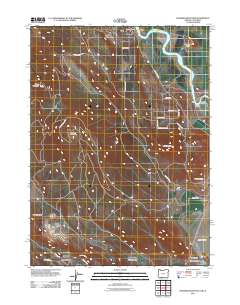
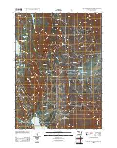
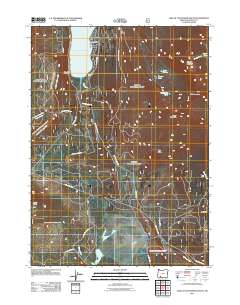
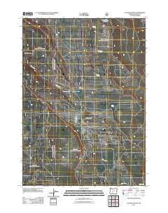
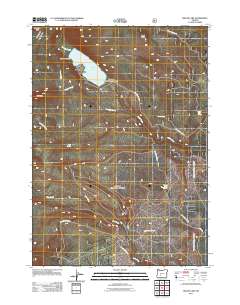
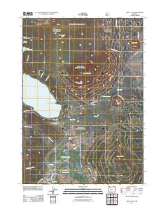
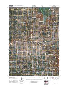
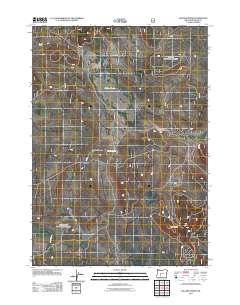
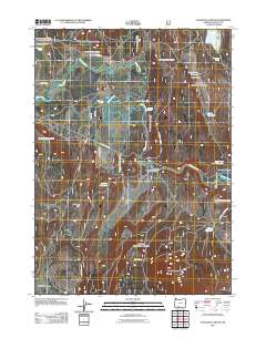
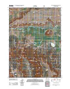
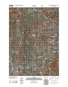
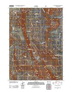
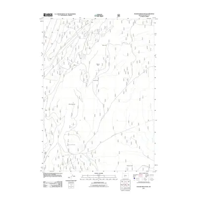
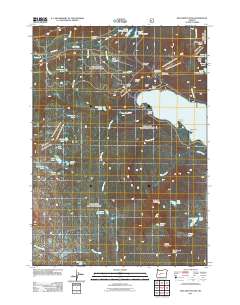
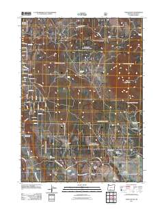
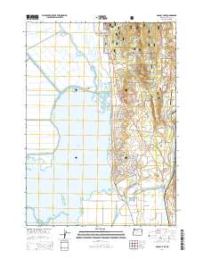
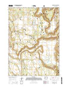
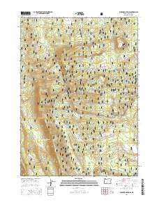
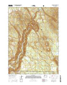
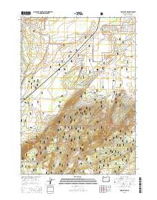
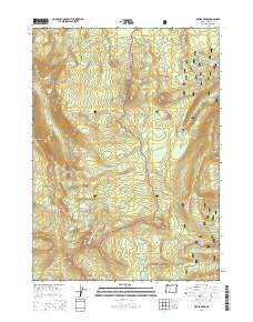
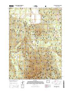
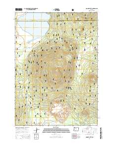
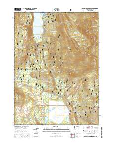
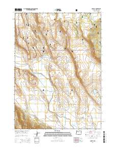
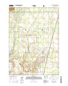
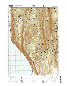
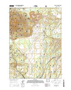
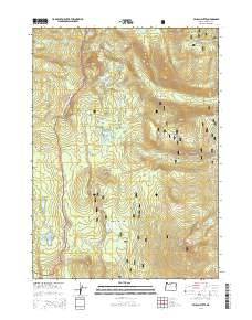
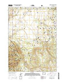
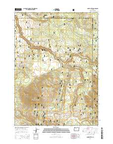
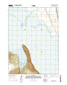
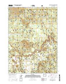
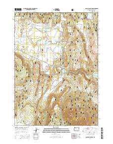
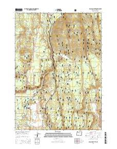
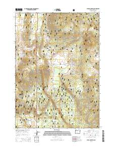
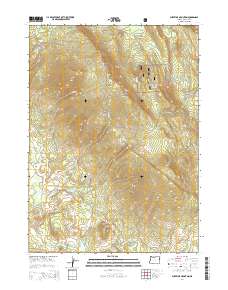
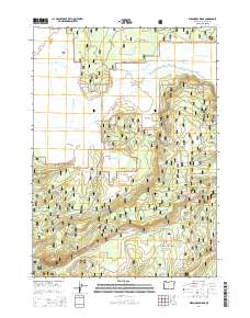
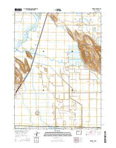
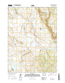
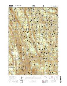
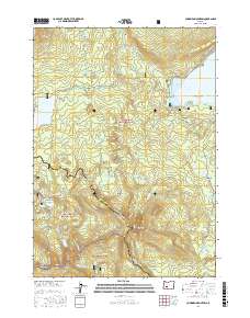
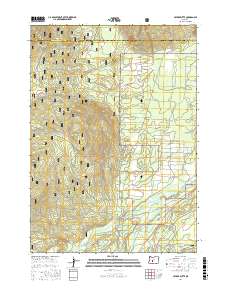
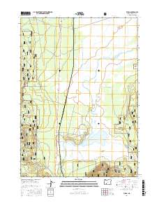
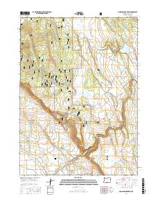
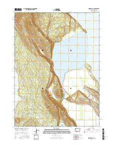
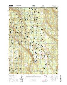
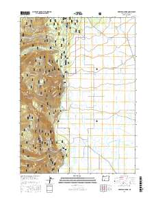
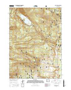
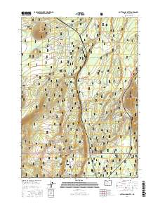
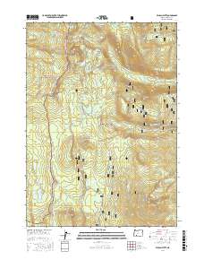
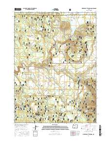
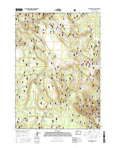
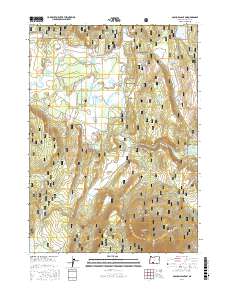
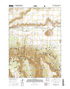
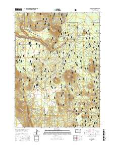
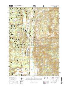
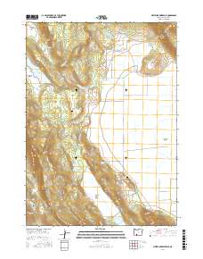
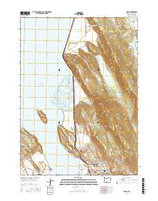
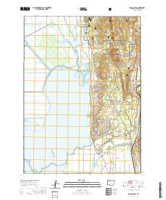
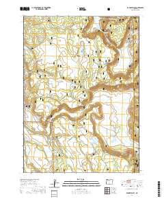
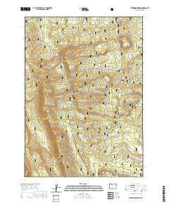
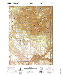
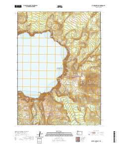
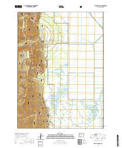
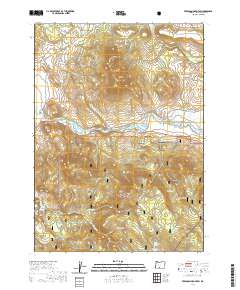
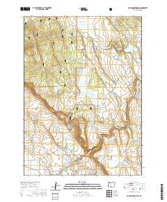
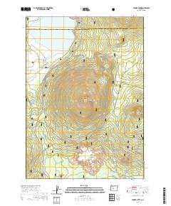
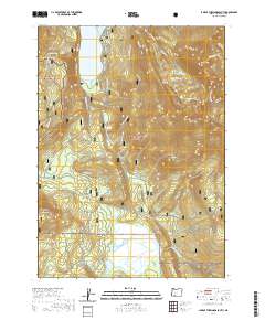
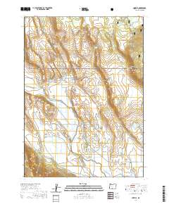
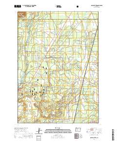
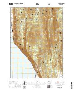
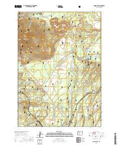
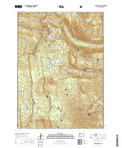
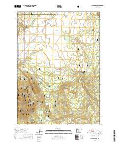
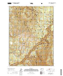
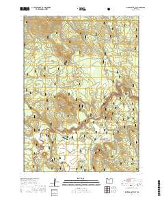
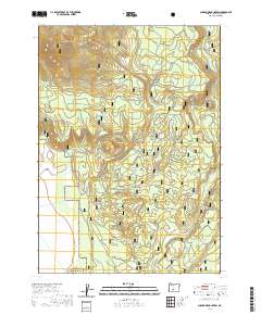
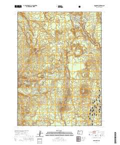
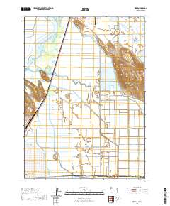
1975 Map of Klamath Falls NE
USGS Topo · Published 1979About this map
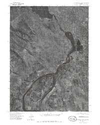
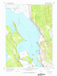
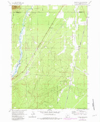
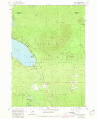
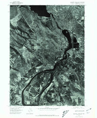
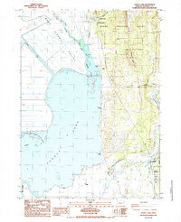
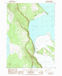
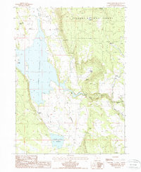
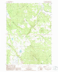
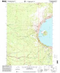
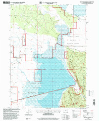
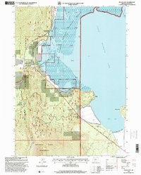
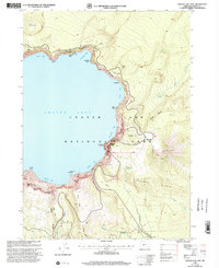
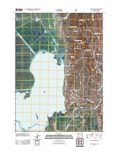
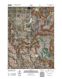
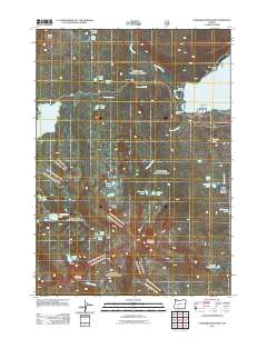
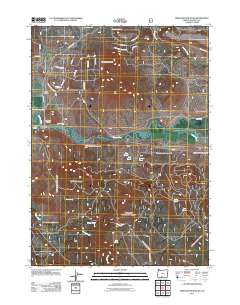
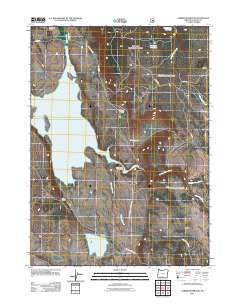
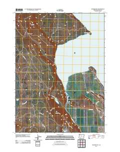
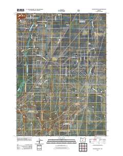
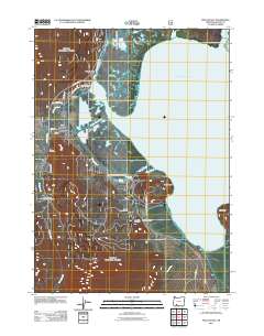
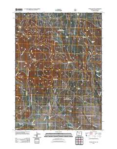
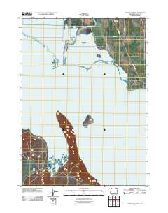
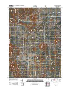
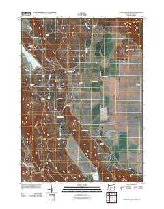
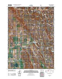
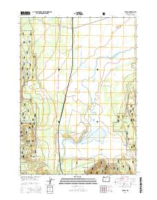
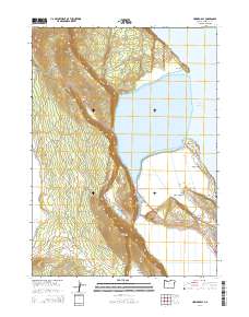
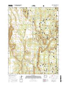
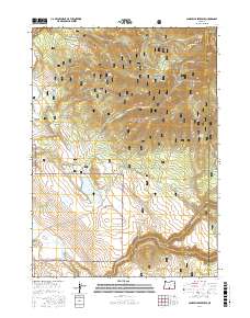
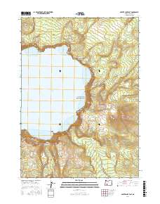
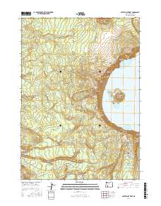
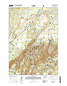
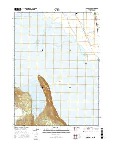
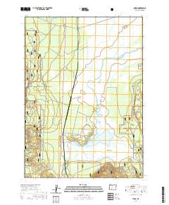
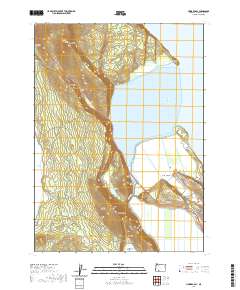
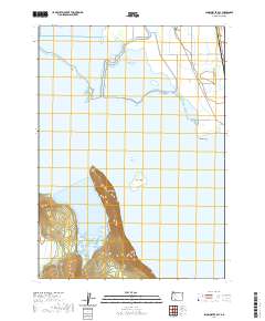
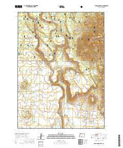
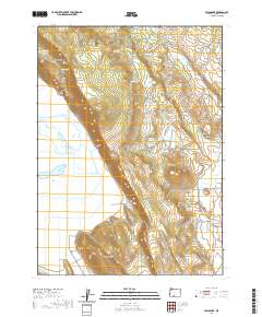
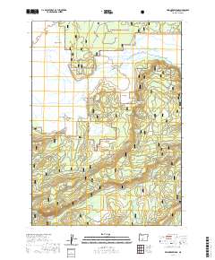
Upper Klamath Lake and the Klamath River dominate this 1975 aerial orthophoto, revealing the hydraulic and industrial character of the landscape just south of Klamath Falls. Unlike a traditional topographic map, this imagery-based study provides a direct view of the mid-1970s land use, capturing the complex network of agricultural fields, irrigation channels, and industrial infrastructure that follows the river's path. The settlement at Midland is visible in the southern portion, situated amidst the reclaimed marshlands that define the region's agricultural economy.
Find a feature on this map
5 named features on this map. Tap any name to fly to it.
Don’t see what you’re looking for? This feature index may not catch every label — zoom into the map to look around manually.
Map Details
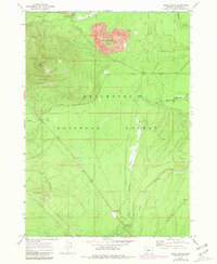
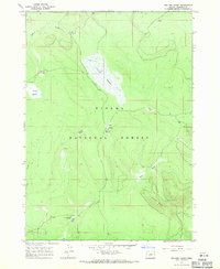
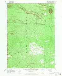
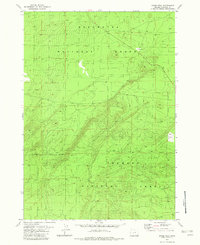
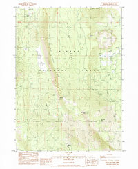
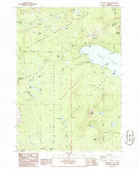
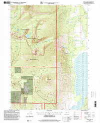
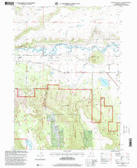
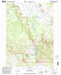
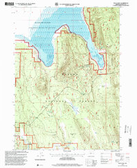
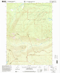
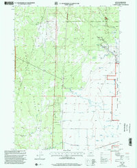
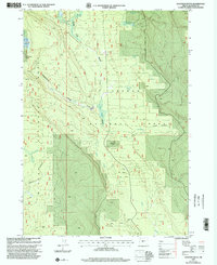
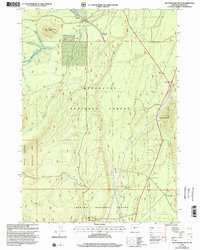
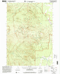
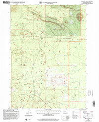
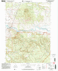
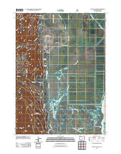
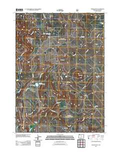
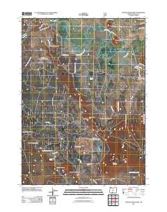
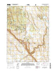
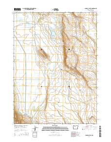
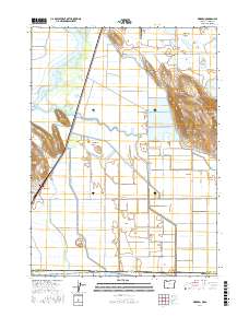
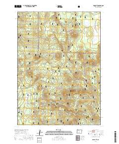
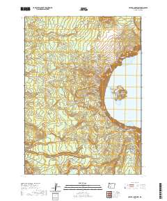
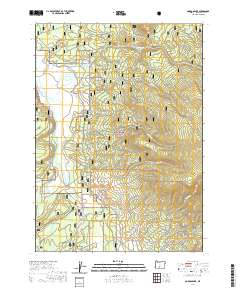
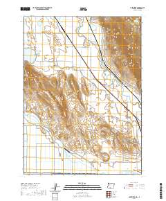
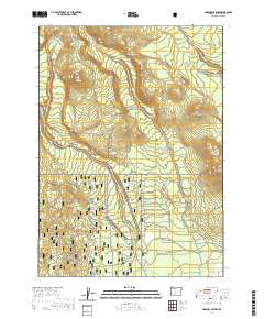
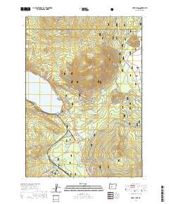
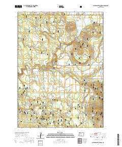
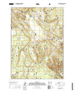
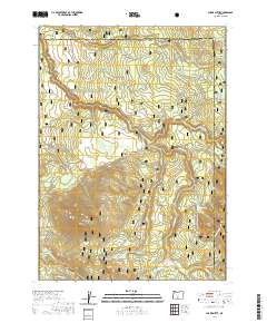
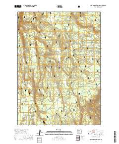
Editions of this 1975 Klamath Falls NE Map
2 editions found
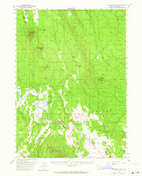
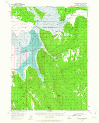
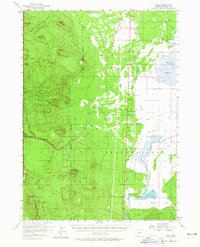
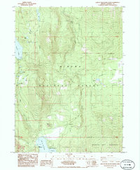
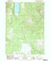
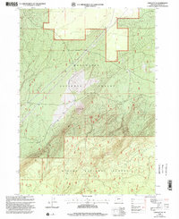
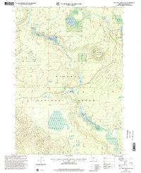
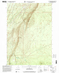
Historical Maps of Klamath Falls Through Time
663 maps found

1889 Klamath
Klamath County, OR
1894 Klamath
Klamath County, OR
1955 Lake of the Woods
Klamath County, OR
1955 Pelican Butte
Klamath County, OR
1955 Surveyor Mtn
Klamath County, OR
1956 Calimus Butte
Klamath County, OR
1957 Klamath Marsh
Klamath County, OR
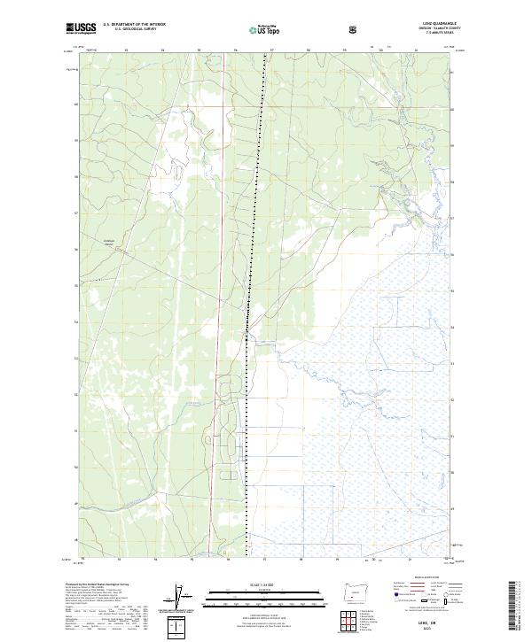
1957 Lenz
Klamath County, OR
1957 Modoc Point
Klamath County, OR
1957 Swan Lake
Klamath County, OR
1960 Fuego Mountain
Klamath County, OR
1960 Gerber Reservoir
Klamath County, OR
1960 Riverbed Butte
Klamath County, OR
1960 Yamsay Mountain
Klamath County, OR
1963 Cryder Butte
Klamath County, OR
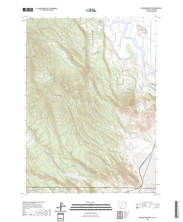
1963 Hamner Butte
Klamath County, OR
1963 Masten Butte
Klamath County, OR
1963 Moffitt Butte
Klamath County, OR

1963 Odell Lake
Klamath County, OR
1966 Sandhill Crossing
Klamath County, OR
1966 Shake Butte
Klamath County, OR
1967 Burn Butte
Klamath County, OR
1967 Crescent NE
Klamath County, OR
1967 Mazama
Klamath County, OR
1967 Miller Lake
Klamath County, OR
1967 Muttonchop Butte
Klamath County, OR
1967 Odell Butte
Klamath County, OR
1967 Odell Lake
Klamath County, OR
1967 Sellers Marsh
Klamath County, OR
1967 Walker Mtn
Klamath County, OR
1967 Welch Butte
Klamath County, OR
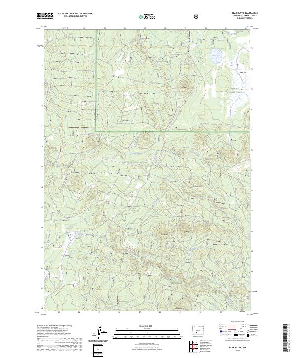
1968 Bear Butte
Klamath County, OR
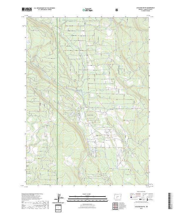
1968 Location Butte
Klamath County, OR
1968 Round Butte
Klamath County, OR
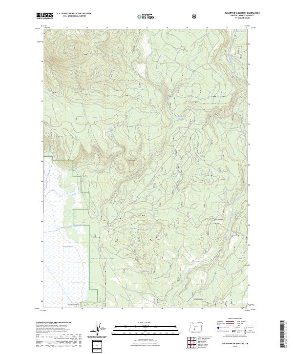
1968 Sugarpine Mtn.
Klamath County, OR
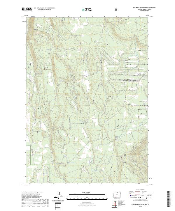
1968 Sugarpine Mtn. NW
Klamath County, OR
1968 Tea Table Mtn
Klamath County, OR
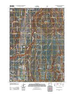
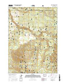
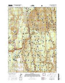
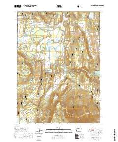
1975 Klamath Falls NE
Klamath County, OR
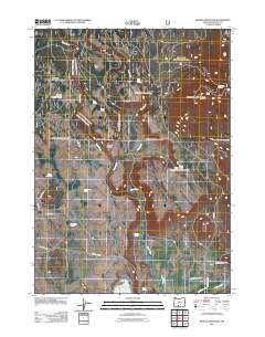
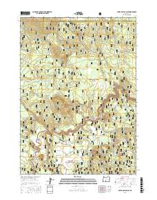
1975 Merrill NW
Klamath County, OR
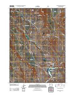
1975 Prospect 1 NW
Klamath County, OR
1980 Williamson River
Klamath County, OR
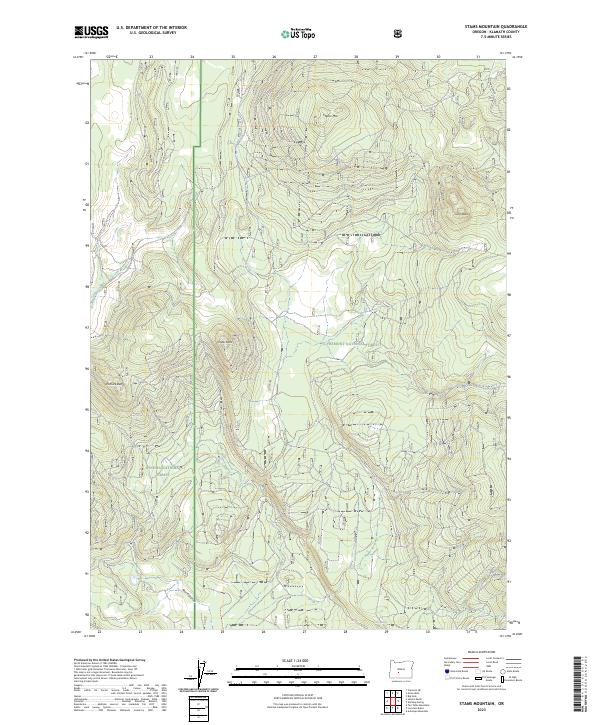
1981 Stams Mtn
Klamath County, OR
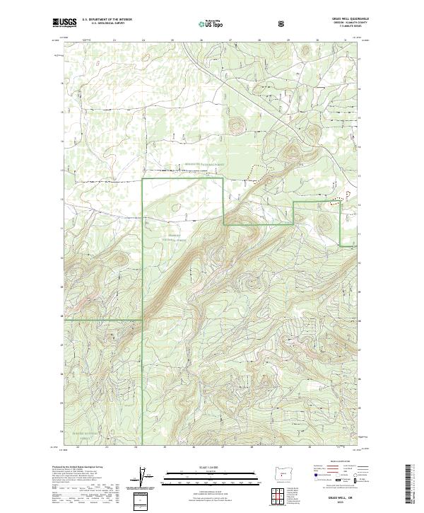
1982 Grass Well
Klamath County, OR
1985 Agency Lake
Klamath County, OR
1985 Aspen Lake
Klamath County, OR
1985 Crater Lake East
Klamath County, OR
1985 Crater Lake West
Klamath County, OR
1985 Crystal Spring
Klamath County, OR
1985 Dairy
Klamath County, OR
1985 Devils Peak
Klamath County, OR
1985 Howard Bay
Klamath County, OR
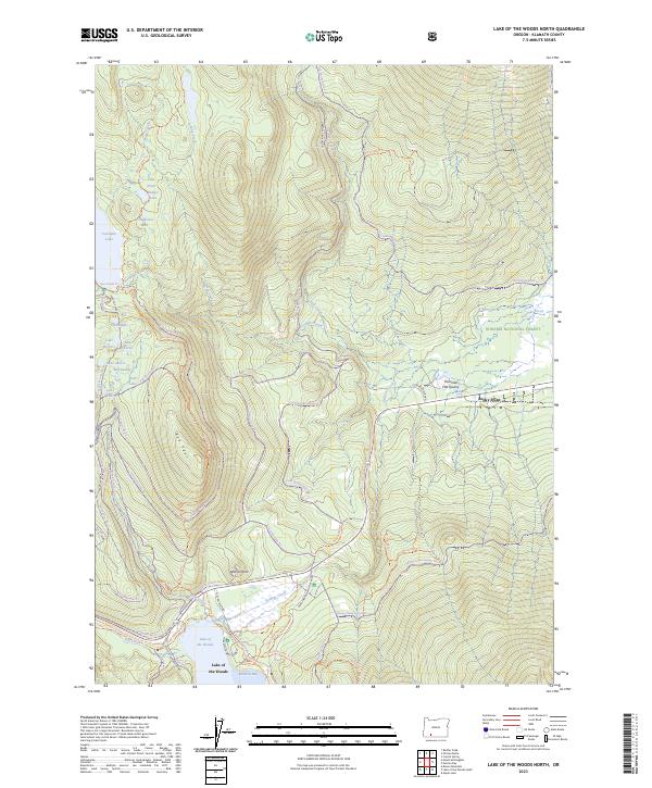
1985 Lake of The Woods North
Klamath County, OR
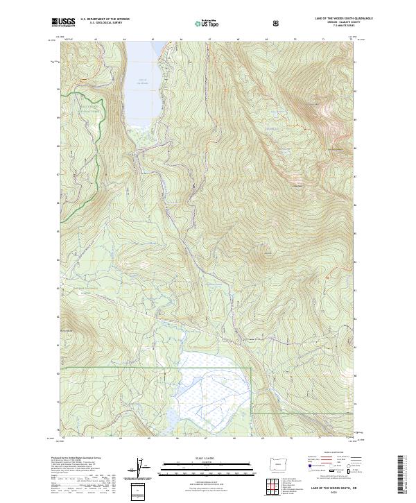
1985 Lake of The Woods South
Klamath County, OR
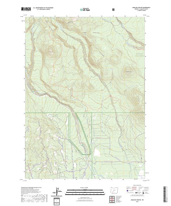
1985 Maklaks Crater
Klamath County, OR
1985 Mares Egg Spring
Klamath County, OR
1985 Modoc Point
Klamath County, OR
1985 Mule Hill
Klamath County, OR
1985 Pelican Bay
Klamath County, OR
1985 Pelican Butte
Klamath County, OR
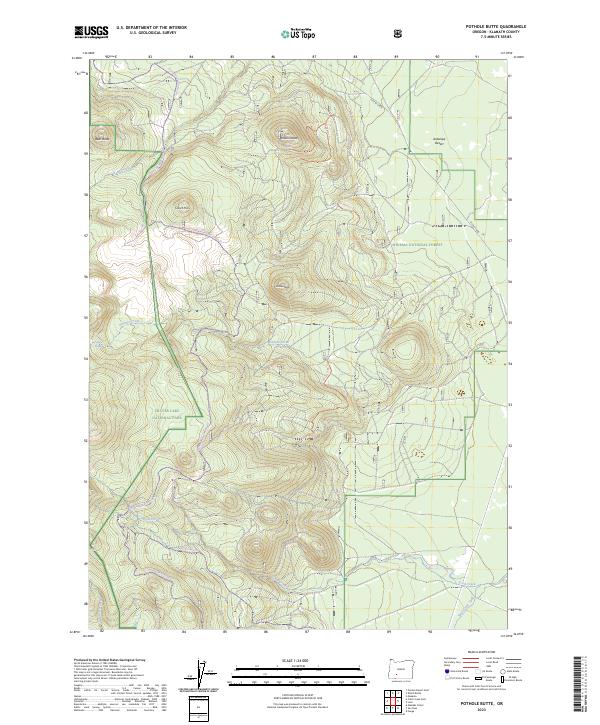
1985 Pothole Butte
Klamath County, OR
1985 Pumice Desert East
Klamath County, OR
1985 Shoalwater Bay
Klamath County, OR
1985 Sprague River West
Klamath County, OR
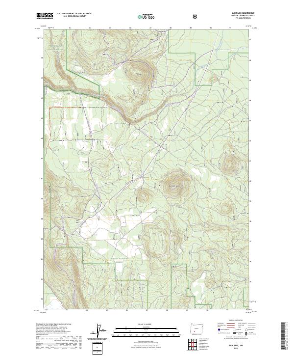
1985 Sun Pass
Klamath County, OR
1985 Surveyor Mountain
Klamath County, OR
1985 Swan Lake
Klamath County, OR
1985 Swan Lake Point
Klamath County, OR
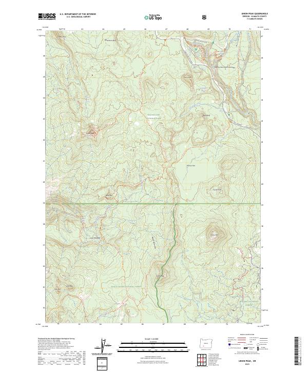
1985 Union Peak
Klamath County, OR
1985 Whiteline Reservoir
Klamath County, OR
1985 Wocus
Klamath County, OR
1986 Chicken Hills
Klamath County, OR
1986 Cowhorn Mtn
Klamath County, OR
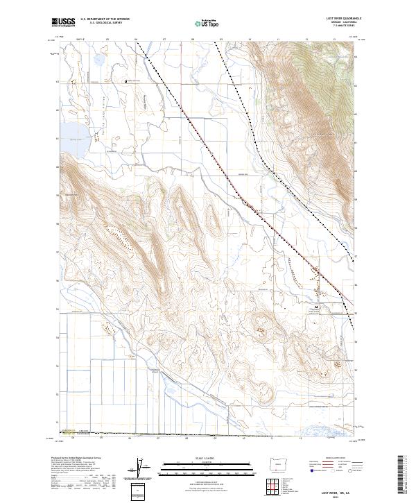
1986 Lost River
Klamath County, OR
1986 Spencer Creek
Klamath County, OR
1986 Willamette Pass
Klamath County, OR
1986 Worden
Klamath County, OR
1988 Antler Point
Klamath County, OR
1988 Applegate Butte
Klamath County, OR
1988 Barnes Valley
Klamath County, OR
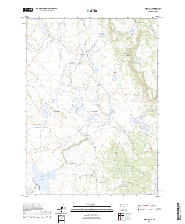
1988 Brady Butte
Klamath County, OR
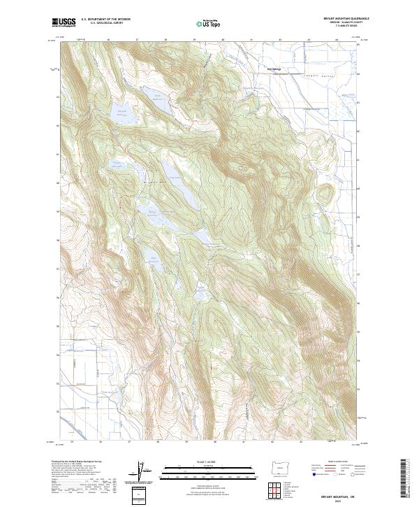
1988 Bryant Mountain
Klamath County, OR
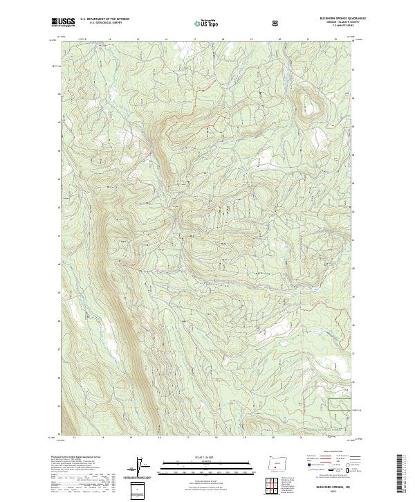
1988 Buckhorn Springs
Klamath County, OR
1988 Buttes of The Gods
Klamath County, OR
1988 Calimus Butte
Klamath County, OR
1988 Campbell Reservoir
Klamath County, OR
1988 Cooks Mtn
Klamath County, OR
1988 Dry Prairie
Klamath County, OR
1988 Ferguson Mountain
Klamath County, OR
1988 Fuego
Klamath County, OR
1988 Fuego Mountain
Klamath County, OR
1988 Gerber Reservoir
Klamath County, OR
1988 Goodlow Mountain
Klamath County, OR
1988 Gordon Lake
Klamath County, OR
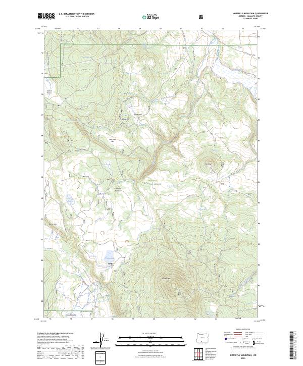
1988 Horsefly Mountain
Klamath County, OR
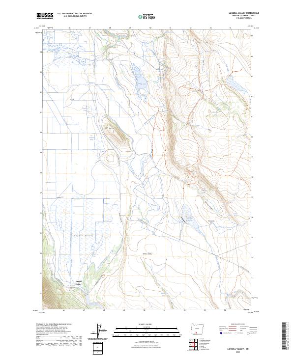
1988 Langell Valley
Klamath County, OR
1988 Lenz
Klamath County, OR
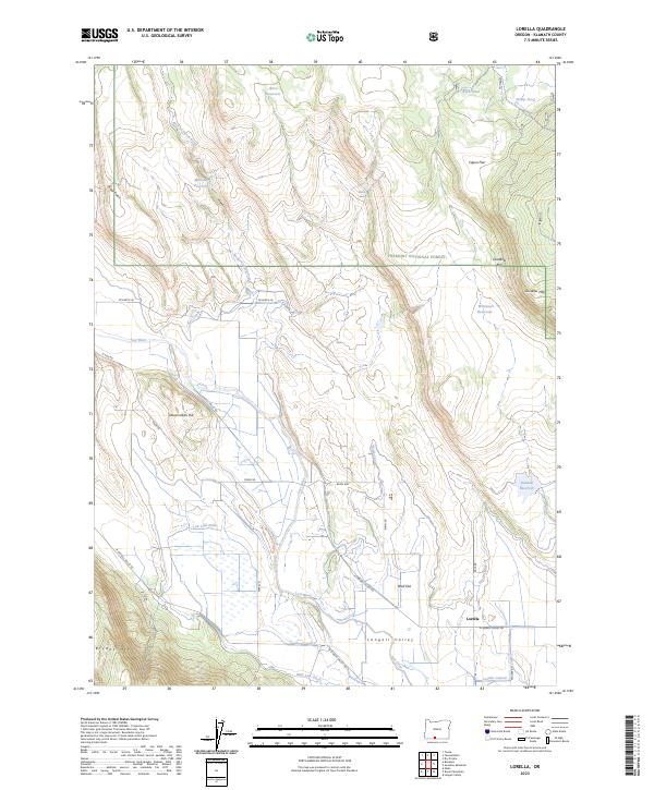
1988 Lorella
Klamath County, OR
1988 Military Crossing
Klamath County, OR
1988 Paradise Mountain
Klamath County, OR
1988 Ponina Butte
Klamath County, OR
1988 Riverbed Butte
Klamath County, OR
1988 Riverbed Butte Spring
Klamath County, OR
1988 Rodeo Butte
Klamath County, OR
1988 Silver Dollar Flat
Klamath County, OR
1988 S'Ocholis Canyon
Klamath County, OR
1988 Soloman Butte
Klamath County, OR
1988 Spodue Mtn
Klamath County, OR
1988 Sprague River East
Klamath County, OR
1988 The Bull Pasture
Klamath County, OR
1988 Wildhorse Ridge
Klamath County, OR
1988 Wocus Bay
Klamath County, OR
1988 Yainax Butte
Klamath County, OR
1988 Yonna
Klamath County, OR
1997 Cowhorn Mountain
Klamath County, OR
1997 Crater Lake West
Klamath County, OR
1997 Willamette Pass
Klamath County, OR
1998 Agency Lake
Klamath County, OR
1998 Applegate Butte
Klamath County, OR
1998 Aspen Lake
Klamath County, OR
1998 Buckhorn Springs
Klamath County, OR
1998 Buttes of The Gods
Klamath County, OR
1998 Calimus Butte
Klamath County, OR
1998 Cooks Mountain
Klamath County, OR
1998 Crystal Spring
Klamath County, OR
1998 Devils Peak
Klamath County, OR
1998 Fuego
Klamath County, OR
1998 Fuego Mountain
Klamath County, OR
1998 Gordon Lake
Klamath County, OR
1998 Lake of The Woods North
Klamath County, OR
1998 Lake of The Woods South
Klamath County, OR
1998 Maklaks Crater
Klamath County, OR
1998 Mares Egg Spring
Klamath County, OR
1998 Military Crossing
Klamath County, OR
1998 Modoc Point
Klamath County, OR
1998 Pelican Bay
Klamath County, OR
1998 Pelican Butte
Klamath County, OR
1998 Riverbed Butte Spring
Klamath County, OR
1998 Silver Dollar Flat
Klamath County, OR
1998 S'Ocholis Canyon
Klamath County, OR
1998 Soloman Butte
Klamath County, OR
1998 Spencer Creek
Klamath County, OR
1998 Spodue Mountain
Klamath County, OR
1998 Sprague River East
Klamath County, OR
1998 Sprague River West
Klamath County, OR
1998 Sun Pass
Klamath County, OR
1998 Surveyor Mountain
Klamath County, OR
1998 Swan Lake Point
Klamath County, OR
1998 The Bull Pasture
Klamath County, OR
1998 Union Peak
Klamath County, OR
1998 Wildhorse Ridge
Klamath County, OR
1998 Wocus Bay
Klamath County, OR
1998 Yainax Butte
Klamath County, OR
1998 Yonna
Klamath County, OR
1999 Bear Butte
Klamath County, OR
1999 Burn Butte
Klamath County, OR
1999 Crater Lake East
Klamath County, OR
1999 Crescent NE
Klamath County, OR
1999 Grass Well
Klamath County, OR
1999 Lenz
Klamath County, OR
1999 Location Butte
Klamath County, OR
1999 Mazama
Klamath County, OR
1999 Miller Lake
Klamath County, OR
1999 Muttonchop Butte
Klamath County, OR
1999 Pothole Butte
Klamath County, OR
1999 Pumice Desert East
Klamath County, OR
1999 Round Butte
Klamath County, OR
1999 Sellers Marsh
Klamath County, OR
1999 Stams Mountain
Klamath County, OR
1999 Sugarpine Mountain
Klamath County, OR
1999 Sugarpine Mountain NW
Klamath County, OR
1999 Tea Table Mountain
Klamath County, OR
1999 Walker Mountain
Klamath County, OR
1999 Welch Butte
Klamath County, OR
2001 Chicken Hills
Klamath County, OR
2001 Mule Hill
Klamath County, OR
2004 Antler Point
Klamath County, OR
2004 Barnes Valley
Klamath County, OR
2004 Campbell Reservoir
Klamath County, OR
2004 Ferguson Mountain
Klamath County, OR
2004 Gerber Reservoir
Klamath County, OR
2004 Goodlow Mountain
Klamath County, OR
2004 Horsefly Mountain
Klamath County, OR
2004 Lorella
Klamath County, OR
2004 Ponina Butte
Klamath County, OR
2004 Riverbed Butte
Klamath County, OR
2004 Sandhill Crossing
Klamath County, OR
2004 Shake Butte
Klamath County, OR
2011 Agency Lake
Klamath County, OR
2011 Antler Point
Klamath County, OR
2011 Applegate Butte
Klamath County, OR
2011 Aspen Lake
Klamath County, OR
2011 Barnes Valley
Klamath County, OR
2011 Bear Butte
Klamath County, OR
2011 Brady Butte
Klamath County, OR
2011 Bryant Mountain
Klamath County, OR
2011 Buckhorn Springs
Klamath County, OR
2011 Burn Butte
Klamath County, OR
2011 Buttes of the Gods
Klamath County, OR
2011 Calimus Butte
Klamath County, OR
2011 Campbell Reservoir
Klamath County, OR
2011 Cooks Mountain
Klamath County, OR
2011 Cowhorn Mountain
Klamath County, OR
2011 Crater Lake East
Klamath County, OR
2011 Crater Lake West
Klamath County, OR
2011 Crescent NE
Klamath County, OR
2011 Cryder Butte
Klamath County, OR
2011 Crystal Spring
Klamath County, OR
2011 Dairy
Klamath County, OR
2011 Devils Peak
Klamath County, OR
2011 Dry Prairie
Klamath County, OR
2011 Ferguson Mountain
Klamath County, OR
2011 Fuego
Klamath County, OR
2011 Fuego Mountain
Klamath County, OR
2011 Gerber Reservoir
Klamath County, OR
2011 Goodlow Mountain
Klamath County, OR
2011 Gordon Lake
Klamath County, OR
2011 Grass Well
Klamath County, OR
2011 Hamaker Mountain
Klamath County, OR
2011 Hamner Butte
Klamath County, OR
2011 Horsefly Mountain
Klamath County, OR
2011 Howard Bay
Klamath County, OR
2011 Lake of the Woods North
Klamath County, OR
2011 Lake of the Woods South
Klamath County, OR
2011 Langell Valley
Klamath County, OR
2011 Lenz
Klamath County, OR
2011 Location Butte
Klamath County, OR
2011 Lorella
Klamath County, OR
2011 Lost River
Klamath County, OR
2011 Maklaks Crater
Klamath County, OR
2011 Mares Egg Spring
Klamath County, OR
2011 Masten Butte
Klamath County, OR
2011 Mazama
Klamath County, OR
2011 Military Crossing
Klamath County, OR
2011 Miller Lake
Klamath County, OR
2011 Modoc Point
Klamath County, OR
2011 Moffitt Butte
Klamath County, OR
2011 Muttonchop Butte
Klamath County, OR

2011 Odell Butte
Klamath County, OR
2011 Odell Lake
Klamath County, OR
2011 Paradise Mountain
Klamath County, OR
2011 Pelican Bay
Klamath County, OR
2011 Pelican Butte
Klamath County, OR
2011 Ponina Butte
Klamath County, OR
2011 Pothole Butte
Klamath County, OR
2011 Pumice Desert East
Klamath County, OR
2011 Riverbed Butte
Klamath County, OR
2011 Riverbed Butte Spring
Klamath County, OR
2011 Rodeo Butte
Klamath County, OR
2011 Round Butte
Klamath County, OR
2011 Sandhill Crossing
Klamath County, OR
2011 Sellers Marsh
Klamath County, OR
2011 Shake Butte
Klamath County, OR
2011 Shoalwater Bay
Klamath County, OR
2011 Silver Dollar Flat
Klamath County, OR
2011 S'Ocholis Canyon
Klamath County, OR
2011 Soloman Butte
Klamath County, OR
2011 Spencer Creek
Klamath County, OR
2011 Spodue Mountain
Klamath County, OR
2011 Sprague River East
Klamath County, OR
2011 Sprague River West
Klamath County, OR
2011 Stams Mountain
Klamath County, OR
2011 Sugarpine Mountain
Klamath County, OR
2011 Sugarpine Mountain NW
Klamath County, OR
2011 Sun Pass
Klamath County, OR
2011 Surveyor Mountain
Klamath County, OR
2011 Swan Lake
Klamath County, OR
2011 Swan Lake Point
Klamath County, OR
2011 Tea Table Mountain
Klamath County, OR
2011 The Bull Pasture
Klamath County, OR
2011 Union Peak
Klamath County, OR
2011 Walker Mountain
Klamath County, OR
2011 Welch Butte
Klamath County, OR
2011 Whiteline Reservoir
Klamath County, OR
2011 Wildhorse Ridge
Klamath County, OR
2011 Willamette Pass
Klamath County, OR
2011 Wocus Bay
Klamath County, OR
2011 Wocus
Klamath County, OR
2011 Worden
Klamath County, OR
2011 Yainax Butte
Klamath County, OR
2011 Yonna
Klamath County, OR
2012 Chicken Hills
Klamath County, OR
2012 Mule Hill
Klamath County, OR
2014 Agency Lake
Klamath County, OR
2014 Antler Point
Klamath County, OR
2014 Applegate Butte
Klamath County, OR
2014 Aspen Lake
Klamath County, OR
2014 Barnes Valley
Klamath County, OR
2014 Bear Butte
Klamath County, OR
2014 Brady Butte
Klamath County, OR
2014 Bryant Mountain
Klamath County, OR
2014 Buckhorn Springs
Klamath County, OR
2014 Burn Butte
Klamath County, OR
2014 Buttes of the Gods
Klamath County, OR
2014 Calimus Butte
Klamath County, OR

2014 Campbell Reservoir
Klamath County, OR
2014 Chicken Hills
Klamath County, OR
2014 Cooks Mountain
Klamath County, OR
2014 Cowhorn Mountain
Klamath County, OR
2014 Crater Lake East
Klamath County, OR

2014 Crater Lake West
Klamath County, OR
2014 Crescent NE
Klamath County, OR
2014 Cryder Butte
Klamath County, OR
2014 Crystal Spring
Klamath County, OR
2014 Dairy
Klamath County, OR
2014 Devils Peak
Klamath County, OR
2014 Dry Prairie
Klamath County, OR
2014 Ferguson Mountain
Klamath County, OR
2014 Fuego
Klamath County, OR
2014 Fuego Mountain
Klamath County, OR

2014 Gerber Reservoir
Klamath County, OR
2014 Goodlow Mountain
Klamath County, OR

2014 Gordon Lake
Klamath County, OR
2014 Grass Well
Klamath County, OR
2014 Hamaker Mountain
Klamath County, OR
2014 Hamner Butte
Klamath County, OR
2014 Horsefly Mountain
Klamath County, OR
2014 Howard Bay
Klamath County, OR
2014 Lake of the Woods North
Klamath County, OR
2014 Lake of the Woods South
Klamath County, OR
2014 Langell Valley
Klamath County, OR
2014 Lenz
Klamath County, OR
2014 Location Butte
Klamath County, OR
2014 Lorella
Klamath County, OR
2014 Lost River
Klamath County, OR
2014 Maklaks Crater
Klamath County, OR
2014 Mares Egg Spring
Klamath County, OR
2014 Masten Butte
Klamath County, OR
2014 Mazama
Klamath County, OR
2014 Military Crossing
Klamath County, OR
2014 Miller Lake
Klamath County, OR
2014 Modoc Point
Klamath County, OR
2014 Moffitt Butte
Klamath County, OR
2014 Mule Hill
Klamath County, OR
2014 Muttonchop Butte
Klamath County, OR
2014 Odell Butte
Klamath County, OR
2014 Odell Lake
Klamath County, OR
2014 Paradise Mountain
Klamath County, OR
2014 Pelican Bay
Klamath County, OR
2014 Pelican Butte
Klamath County, OR
2014 Ponina Butte
Klamath County, OR
2014 Pothole Butte
Klamath County, OR
2014 Pumice Desert East
Klamath County, OR
2014 Riverbed Butte
Klamath County, OR
2014 Riverbed Butte Spring
Klamath County, OR

2014 Rodeo Butte
Klamath County, OR
2014 Round Butte
Klamath County, OR
2014 Sandhill Crossing
Klamath County, OR

2014 Sellers Marsh
Klamath County, OR
2014 Shake Butte
Klamath County, OR
2014 Shoalwater Bay
Klamath County, OR
2014 Silver Dollar Flat
Klamath County, OR
2014 S'Ocholis Canyon
Klamath County, OR
2014 Soloman Butte
Klamath County, OR
2014 Spencer Creek
Klamath County, OR
2014 Spodue Mountain
Klamath County, OR

2014 Sprague River East
Klamath County, OR
2014 Sprague River West
Klamath County, OR
2014 Stams Mountain
Klamath County, OR
2014 Sugarpine Mountain
Klamath County, OR
2014 Sugarpine Mountain NW
Klamath County, OR
2014 Sun Pass
Klamath County, OR
2014 Surveyor Mountain
Klamath County, OR
2014 Swan Lake
Klamath County, OR
2014 Swan Lake Point
Klamath County, OR
2014 Tea Table Mountain
Klamath County, OR
2014 The Bull Pasture
Klamath County, OR
2014 Union Peak
Klamath County, OR
2014 Walker Mountain
Klamath County, OR
2014 Welch Butte
Klamath County, OR

2014 Whiteline Reservoir
Klamath County, OR
2014 Wildhorse Ridge
Klamath County, OR
2014 Willamette Pass
Klamath County, OR
2014 Wocus Bay
Klamath County, OR
2014 Wocus
Klamath County, OR
2014 Worden
Klamath County, OR
2014 Yainax Butte
Klamath County, OR
2014 Yonna
Klamath County, OR
2017 Agency Lake
Klamath County, OR
2017 Antler Point
Klamath County, OR

2017 Applegate Butte
Klamath County, OR
2017 Aspen Lake
Klamath County, OR
2017 Barnes Valley
Klamath County, OR
2017 Bear Butte
Klamath County, OR
2017 Brady Butte
Klamath County, OR
2017 Bryant Mountain
Klamath County, OR
2017 Buckhorn Springs
Klamath County, OR
2017 Burn Butte
Klamath County, OR

2017 Buttes of the Gods
Klamath County, OR
2017 Calimus Butte
Klamath County, OR
2017 Campbell Reservoir
Klamath County, OR
2017 Chicken Hills
Klamath County, OR
2017 Cooks Mountain
Klamath County, OR
2017 Cowhorn Mountain
Klamath County, OR
2017 Crater Lake East
Klamath County, OR
2017 Crater Lake West
Klamath County, OR
2017 Crescent NE
Klamath County, OR
2017 Cryder Butte
Klamath County, OR
2017 Crystal Spring
Klamath County, OR

2017 Dairy
Klamath County, OR
2017 Devils Peak
Klamath County, OR
2017 Dry Prairie
Klamath County, OR
2017 Ferguson Mountain
Klamath County, OR
2017 Fuego
Klamath County, OR
2017 Fuego Mountain
Klamath County, OR
2017 Gerber Reservoir
Klamath County, OR
2017 Goodlow Mountain
Klamath County, OR
2017 Gordon Lake
Klamath County, OR
2017 Grass Well
Klamath County, OR
2017 Hamaker Mountain
Klamath County, OR
2017 Hamner Butte
Klamath County, OR
2017 Horsefly Mountain
Klamath County, OR
2017 Howard Bay
Klamath County, OR

2017 Lake of the Woods North
Klamath County, OR

2017 Lake of the Woods South
Klamath County, OR

2017 Langell Valley
Klamath County, OR
2017 Lenz
Klamath County, OR
2017 Location Butte
Klamath County, OR
2017 Lorella
Klamath County, OR
2017 Lost River
Klamath County, OR
2017 Maklaks Crater
Klamath County, OR
2017 Mares Egg Spring
Klamath County, OR
2017 Masten Butte
Klamath County, OR
2017 Mazama
Klamath County, OR
2017 Military Crossing
Klamath County, OR
2017 Miller Lake
Klamath County, OR
2017 Modoc Point
Klamath County, OR
2017 Moffitt Butte
Klamath County, OR
2017 Mule Hill
Klamath County, OR
2017 Muttonchop Butte
Klamath County, OR
2017 Odell Butte
Klamath County, OR
2017 Odell Lake
Klamath County, OR
2017 Paradise Mountain
Klamath County, OR

2017 Pelican Bay
Klamath County, OR
2017 Pelican Butte
Klamath County, OR

2017 Ponina Butte
Klamath County, OR
2017 Pothole Butte
Klamath County, OR
2017 Pumice Desert East
Klamath County, OR
2017 Riverbed Butte
Klamath County, OR
2017 Riverbed Butte Spring
Klamath County, OR
2017 Rodeo Butte
Klamath County, OR
2017 Round Butte
Klamath County, OR
2017 Sandhill Crossing
Klamath County, OR
2017 Sellers Marsh
Klamath County, OR
2017 Shake Butte
Klamath County, OR
2017 Shoalwater Bay
Klamath County, OR
2017 Silver Dollar Flat
Klamath County, OR
2017 S'Ocholis Canyon
Klamath County, OR
2017 Soloman Butte
Klamath County, OR
2017 Spencer Creek
Klamath County, OR
2017 Spodue Mountain
Klamath County, OR
2017 Sprague River East
Klamath County, OR

2017 Sprague River West
Klamath County, OR
2017 Stams Mountain
Klamath County, OR
2017 Sugarpine Mountain
Klamath County, OR
2017 Sugarpine Mountain NW
Klamath County, OR
2017 Sun Pass
Klamath County, OR

2017 Surveyor Mountain
Klamath County, OR
2017 Swan Lake
Klamath County, OR
2017 Swan Lake Point
Klamath County, OR
2017 Tea Table Mountain
Klamath County, OR
2017 The Bull Pasture
Klamath County, OR
2017 Union Peak
Klamath County, OR
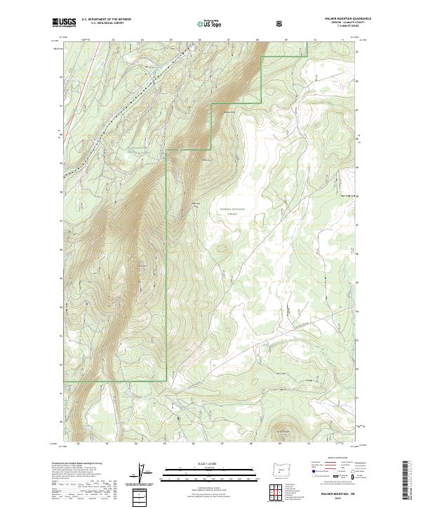
2017 Walker Mountain
Klamath County, OR
2017 Welch Butte
Klamath County, OR
2017 Whiteline Reservoir
Klamath County, OR
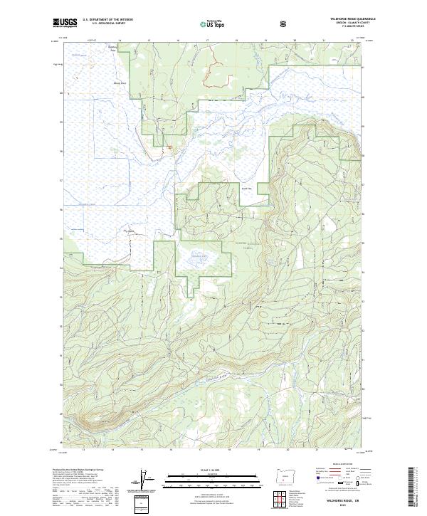
2017 Wildhorse Ridge
Klamath County, OR
2017 Willamette Pass
Klamath County, OR
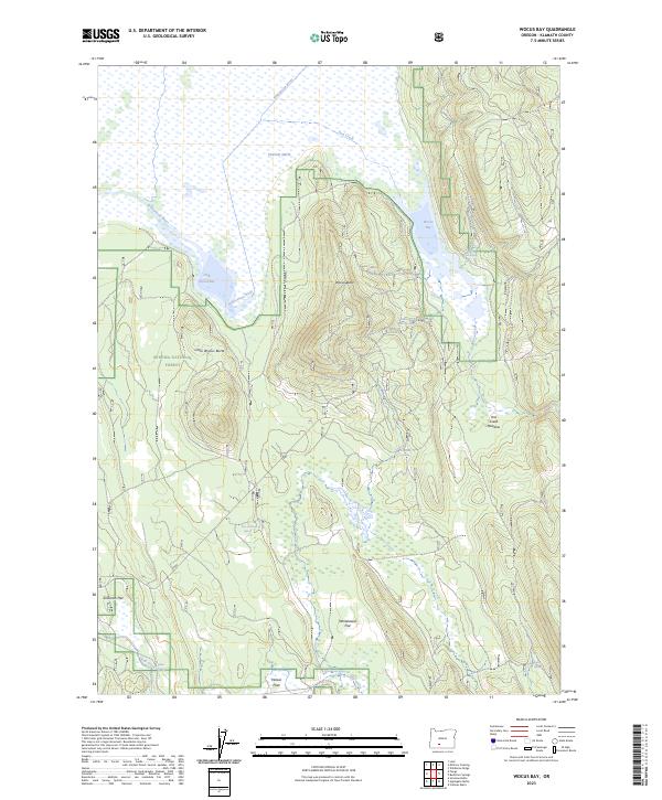
2017 Wocus Bay
Klamath County, OR
2017 Wocus
Klamath County, OR
2017 Worden
Klamath County, OR
2017 Yainax Butte
Klamath County, OR
2017 Yonna
Klamath County, OR
2020 Agency Lake
Klamath County, OR
2020 Antler Point
Klamath County, OR
2020 Applegate Butte
Klamath County, OR
2020 Aspen Lake
Klamath County, OR
2020 Barnes Valley
Klamath County, OR
2020 Bear Butte
Klamath County, OR
2020 Brady Butte
Klamath County, OR
2020 Bryant Mountain
Klamath County, OR
2020 Buckhorn Springs
Klamath County, OR
2020 Burn Butte
Klamath County, OR
2020 Buttes of the Gods
Klamath County, OR
2020 Calimus Butte
Klamath County, OR
2020 Campbell Reservoir
Klamath County, OR
2020 Chicken Hills
Klamath County, OR
2020 Cooks Mountain
Klamath County, OR
2020 Cowhorn Mountain
Klamath County, OR
2020 Crater Lake East
Klamath County, OR
2020 Crater Lake West
Klamath County, OR
2020 Crescent NE
Klamath County, OR
2020 Cryder Butte
Klamath County, OR
2020 Crystal Spring
Klamath County, OR
2020 Dairy
Klamath County, OR
2020 Devils Peak
Klamath County, OR
2020 Dry Prairie
Klamath County, OR
2020 Ferguson Mountain
Klamath County, OR
2020 Fuego
Klamath County, OR
2020 Fuego Mountain
Klamath County, OR
2020 Gerber Reservoir
Klamath County, OR
2020 Goodlow Mountain
Klamath County, OR
2020 Gordon Lake
Klamath County, OR
2020 Grass Well
Klamath County, OR
2020 Hamaker Mountain
Klamath County, OR
2020 Hamner Butte
Klamath County, OR
2020 Horsefly Mountain
Klamath County, OR
2020 Howard Bay
Klamath County, OR
2020 Lake of the Woods North
Klamath County, OR
2020 Lake of the Woods South
Klamath County, OR
2020 Langell Valley
Klamath County, OR
2020 Lenz
Klamath County, OR
2020 Location Butte
Klamath County, OR
2020 Lorella
Klamath County, OR
2020 Lost River
Klamath County, OR
2020 Maklaks Crater
Klamath County, OR
2020 Mares Egg Spring
Klamath County, OR
2020 Masten Butte
Klamath County, OR
2020 Mazama
Klamath County, OR
2020 Military Crossing
Klamath County, OR
2020 Miller Lake
Klamath County, OR
2020 Modoc Point
Klamath County, OR
2020 Moffitt Butte
Klamath County, OR
2020 Mule Hill
Klamath County, OR
2020 Muttonchop Butte
Klamath County, OR
2020 Odell Butte
Klamath County, OR
2020 Odell Lake
Klamath County, OR
2020 Paradise Mountain
Klamath County, OR
2020 Pelican Bay
Klamath County, OR
2020 Pelican Butte
Klamath County, OR
2020 Ponina Butte
Klamath County, OR
2020 Pothole Butte
Klamath County, OR
2020 Pumice Desert East
Klamath County, OR
2020 Riverbed Butte
Klamath County, OR
2020 Riverbed Butte Spring
Klamath County, OR
2020 Rodeo Butte
Klamath County, OR
2020 Round Butte
Klamath County, OR
2020 Sandhill Crossing
Klamath County, OR
2020 Sellers Marsh
Klamath County, OR
2020 Shake Butte
Klamath County, OR
2020 Shoalwater Bay
Klamath County, OR
2020 Silver Dollar Flat
Klamath County, OR
2020 S'Ocholis Canyon
Klamath County, OR
2020 Soloman Butte
Klamath County, OR
2020 Spencer Creek
Klamath County, OR
2020 Spodue Mountain
Klamath County, OR
2020 Sprague River East
Klamath County, OR
2020 Sprague River West
Klamath County, OR
2020 Stams Mountain
Klamath County, OR
2020 Sugarpine Mountain
Klamath County, OR
2020 Sugarpine Mountain NW
Klamath County, OR
2020 Sun Pass
Klamath County, OR
2020 Surveyor Mountain
Klamath County, OR
2020 Swan Lake
Klamath County, OR
2020 Swan Lake Point
Klamath County, OR
2020 Tea Table Mountain
Klamath County, OR
2020 The Bull Pasture
Klamath County, OR
2020 Union Peak
Klamath County, OR
2020 Walker Mountain
Klamath County, OR
2020 Welch Butte
Klamath County, OR
2020 Whiteline Reservoir
Klamath County, OR
2020 Wildhorse Ridge
Klamath County, OR
2020 Willamette Pass
Klamath County, OR
2020 Wocus Bay
Klamath County, OR
2020 Wocus
Klamath County, OR
2020 Worden
Klamath County, OR
2020 Yainax Butte
Klamath County, OR
2020 Yonna
Klamath County, OR
2023 Agency Lake
Klamath County, OR
2023 Antler Point
Klamath County, OR
2023 Applegate Butte
Klamath County, OR
2023 Aspen Lake
Klamath County, OR
2023 Barnes Valley
Klamath County, OR
2023 Bear Butte
Klamath County, OR
2023 Brady Butte
Klamath County, OR
2023 Bryant Mountain
Klamath County, OR
2023 Buckhorn Springs
Klamath County, OR
2023 Burn Butte
Klamath County, OR
2023 Buttes of the Gods
Klamath County, OR
2023 Calimus Butte
Klamath County, OR
2023 Campbell Reservoir
Klamath County, OR
2023 Chicken Hills
Klamath County, OR
2023 Cooks Mountain
Klamath County, OR
2023 Cowhorn Mountain
Klamath County, OR
2023 Crater Lake West
Klamath County, OR
2023 Crescent NE
Klamath County, OR
2023 Dairy
Klamath County, OR
2023 Devils Peak
Klamath County, OR
2023 Ferguson Mountain
Klamath County, OR
2023 Grass Well
Klamath County, OR
2023 Hamaker Mountain
Klamath County, OR
2023 Hamner Butte
Klamath County, OR
2023 Horsefly Mountain
Klamath County, OR
2023 Lake of the Woods North
Klamath County, OR
2023 Lake of the Woods South
Klamath County, OR
2023 Langell Valley
Klamath County, OR
2023 Lenz
Klamath County, OR
2023 Location Butte
Klamath County, OR
2023 Lorella
Klamath County, OR
2023 Lost River
Klamath County, OR
2023 Maklaks Crater
Klamath County, OR
2023 Mares Egg Spring
Klamath County, OR
2023 Mazama
Klamath County, OR
2023 Military Crossing
Klamath County, OR
2023 Miller Lake
Klamath County, OR
2023 Modoc Point
Klamath County, OR
2023 Moffitt Butte
Klamath County, OR
2023 Mule Hill
Klamath County, OR
2023 Muttonchop Butte
Klamath County, OR
2023 Odell Butte
Klamath County, OR
2023 Paradise Mountain
Klamath County, OR
2023 Pelican Butte
Klamath County, OR
2023 Ponina Butte
Klamath County, OR
2023 Pothole Butte
Klamath County, OR
2023 Riverbed Butte
Klamath County, OR
2023 Rodeo Butte
Klamath County, OR
2023 Round Butte
Klamath County, OR
2023 Sandhill Crossing
Klamath County, OR
2023 Sellers Marsh
Klamath County, OR
2023 Shake Butte
Klamath County, OR
2023 Silver Dollar Flat
Klamath County, OR
2023 Soloman Butte
Klamath County, OR
2023 Spodue Mountain
Klamath County, OR
2023 Sprague River East
Klamath County, OR
2023 Sprague River West
Klamath County, OR
2023 Stams Mountain
Klamath County, OR
2023 Sugarpine Mountain
Klamath County, OR
2023 Sugarpine Mountain NW
Klamath County, OR
2023 Sun Pass
Klamath County, OR
2023 Surveyor Mountain
Klamath County, OR
2023 Swan Lake
Klamath County, OR
2023 Swan Lake Point
Klamath County, OR
2023 The Bull Pasture
Klamath County, OR
2023 Union Peak
Klamath County, OR
2023 Walker Mountain
Klamath County, OR
2023 Wildhorse Ridge
Klamath County, OR
2023 Wocus Bay
Klamath County, OR
2023 Yainax Butte
Klamath County, OR
2023 Yonna
Klamath County, OR
2024 Agency Lake
Klamath County, OR
2024 Crater Lake East
Klamath County, OR
2024 Cryder Butte
Klamath County, OR
2024 Crystal Spring
Klamath County, OR
2024 Dry Prairie
Klamath County, OR
2024 Fuego
Klamath County, OR
2024 Fuego Mountain
Klamath County, OR
2024 Gerber Reservoir
Klamath County, OR
2024 Goodlow Mountain
Klamath County, OR
2024 Gordon Lake
Klamath County, OR
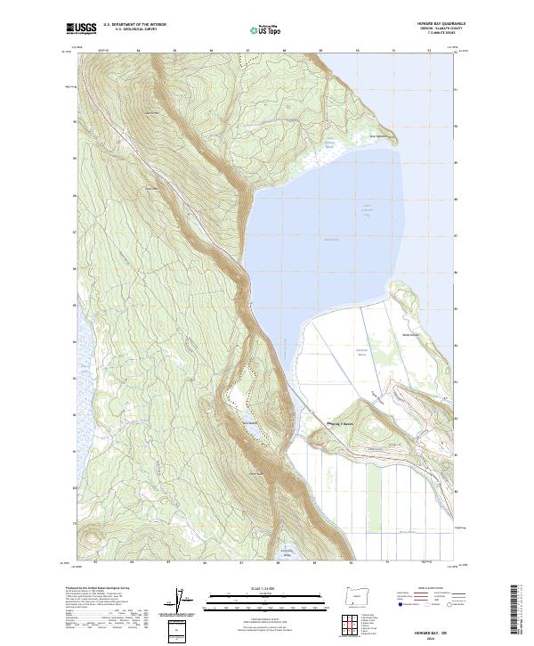
2024 Howard Bay
Klamath County, OR
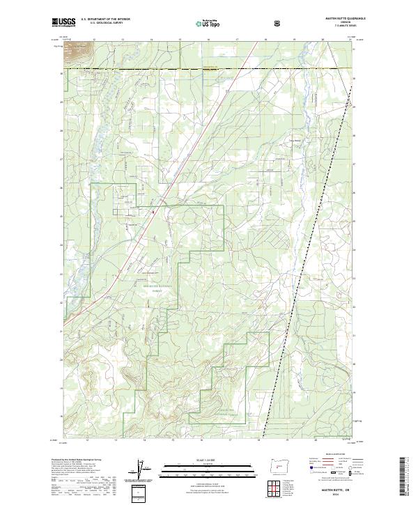
2024 Masten Butte
Klamath County, OR
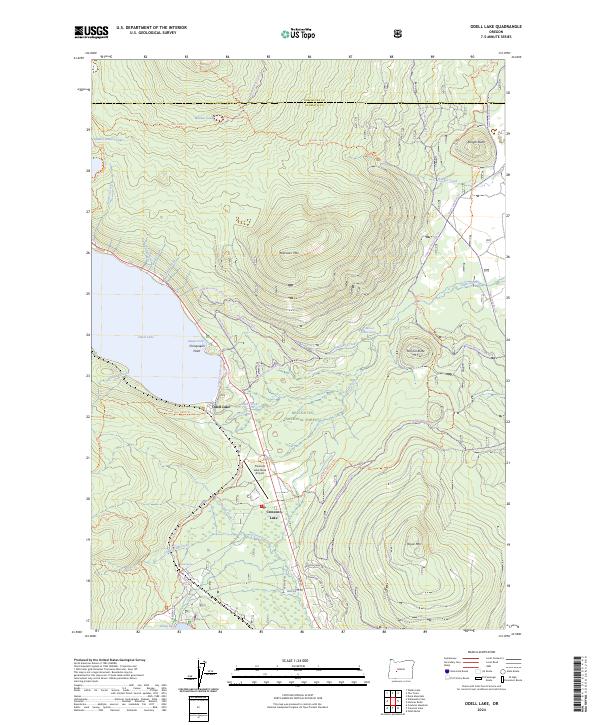
2024 Odell Lake
Klamath County, OR
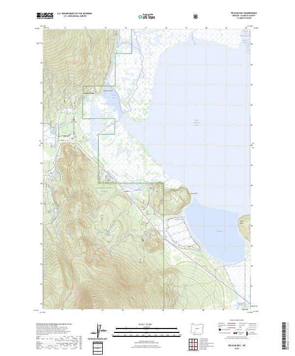
2024 Pelican Bay
Klamath County, OR
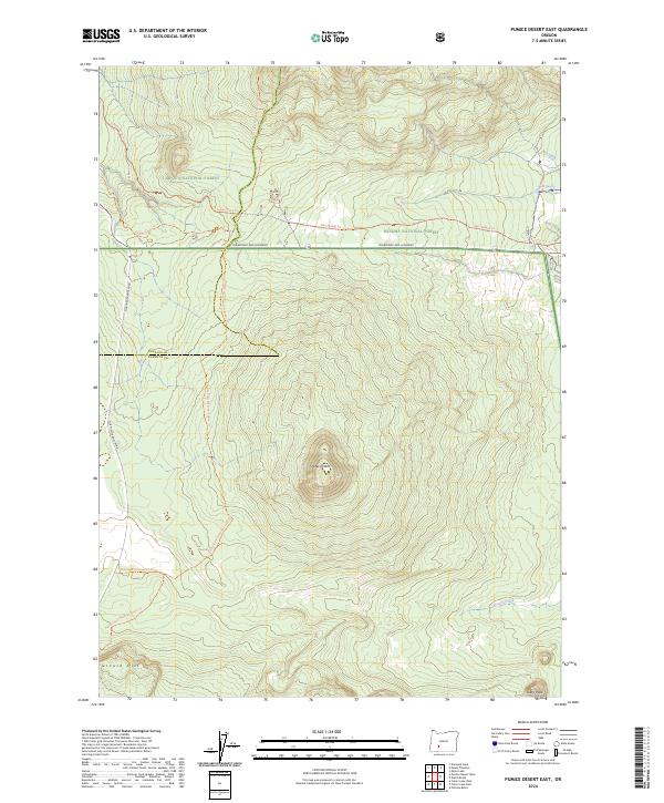
2024 Pumice Desert East
Klamath County, OR
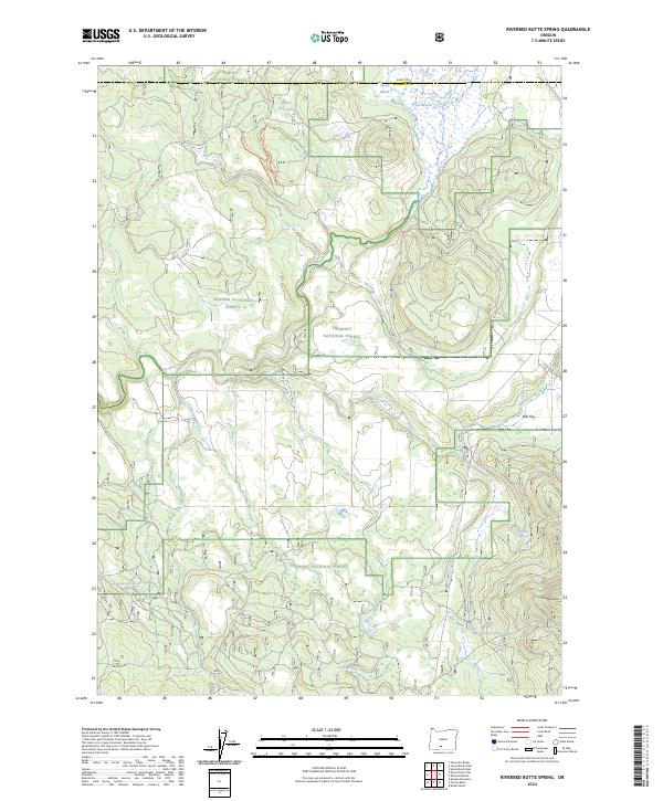
2024 Riverbed Butte Spring
Klamath County, OR
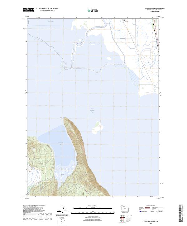
2024 Shoalwater Bay
Klamath County, OR
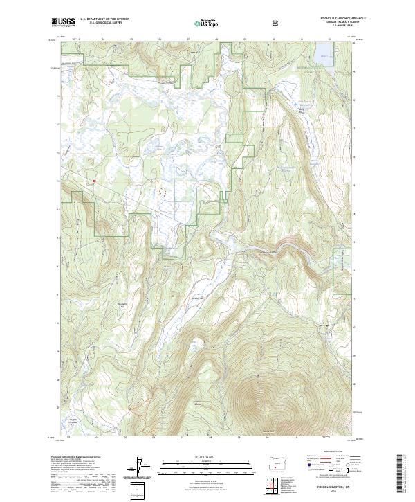
2024 S'Ocholis Canyon
Klamath County, OR
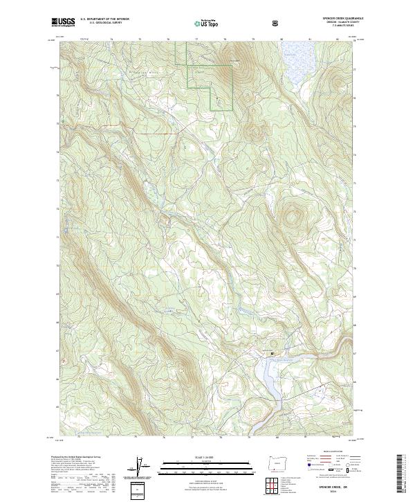
2024 Spencer Creek
Klamath County, OR
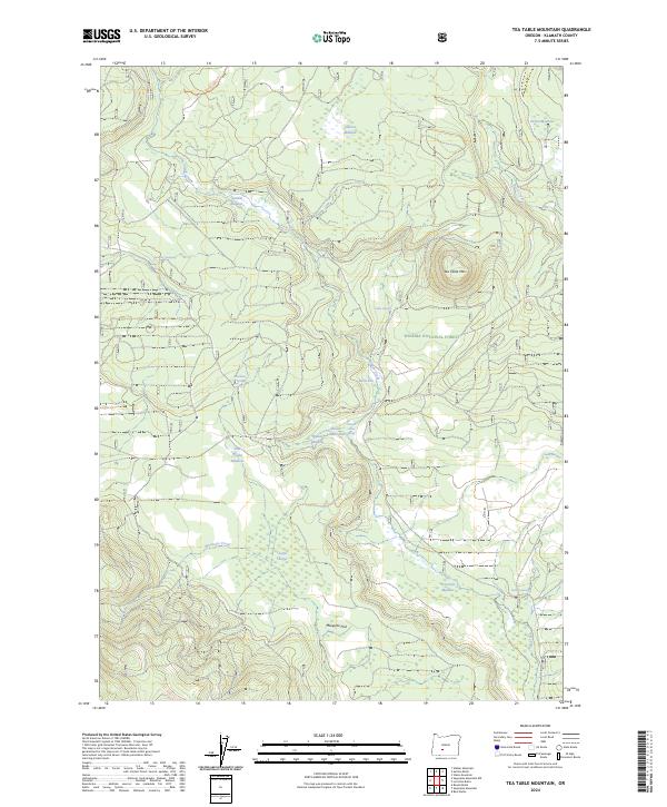
2024 Tea Table Mountain
Klamath County, OR
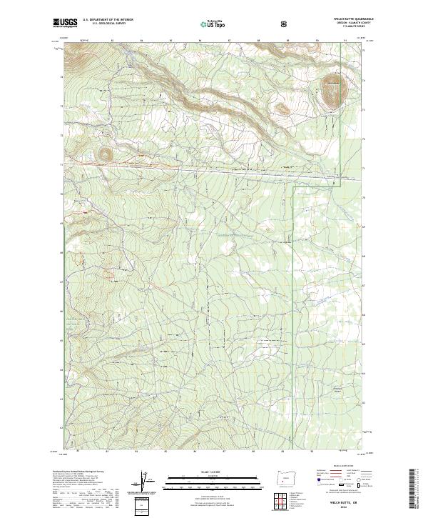
2024 Welch Butte
Klamath County, OR
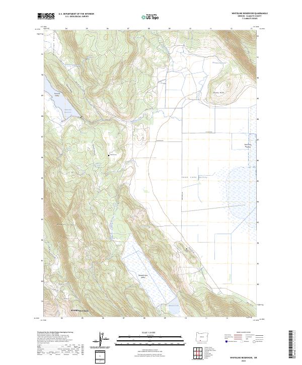
2024 Whiteline Reservoir
Klamath County, OR
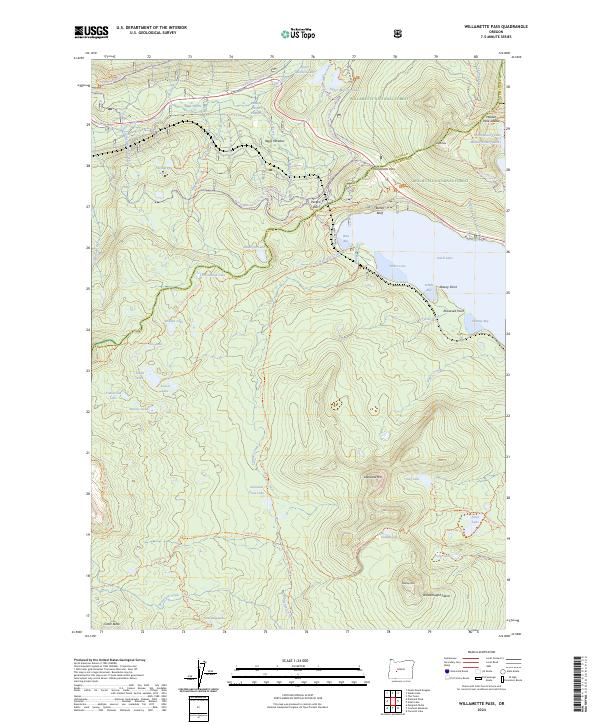
2024 Willamette Pass
Klamath County, OR
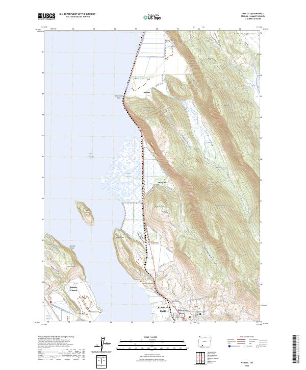
2024 Wocus
Klamath County, OR
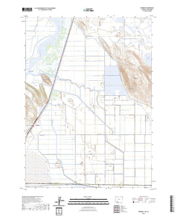
2024 Worden
Klamath County, OR