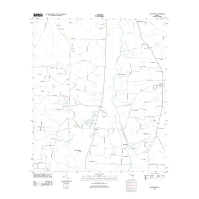
2012 Map of Altha West
USGS Topo · Published 2012About this map
The Chipola River carves a winding path through this portion of Calhoun County, defining a landscape of wetlands and small agricultural settlements. In the center of the sheet, the community of Willis serves as a local crossroads near the Old Shiloh Cem, while the small hamlet of Chason sits just to the south. The area is notable for its high density of family and community burial grounds, including Maddox Cem, Mount Olive Cem, and the Gortemoller Cem, providing significant touchpoints for genealogical research in this rural corridor. Aviation and forestry interests are evident through the Farm Air Service Airport near Cox and the Hanna Lookout Tower further east. Water features like Double Pond, White Pond, and Gem Bay dot the western reaches, illustrating the complex hydrography of the Florida panhandle's interior.
Find a feature on this map
130 named features on this map. Tap any name to fly to it.
Don’t see what you’re looking for? This feature index may not catch every label — zoom into the map to look around manually.
Map Details
Editions of this 2012 Altha West Map
This is the sole edition of this map. No revisions or reprints were ever made.
Other maps of this area

1944 · Clarksville
USGS Topo · 1:31,680

1945 · Juniper Creek
USGS Topo · 1:31,680

1945 · Blountstown
USGS Topo · 1:31,680

1945 · Clarksville
USGS Topo · 1:31,680

1952 · Cypress
USGS Topo · 1:24,000

1952 · Oakdale
USGS Topo · 1:24,000

1952 · Kynesville
USGS Topo · 1:24,000

1952 · Alford SE
USGS Topo · 1:24,000

1952 · Altha West
USGS Topo · 1:24,000

1952 · Altha East
USGS Topo · 1:24,000