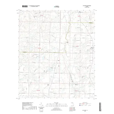
2018 Map of Altha West
USGS Topo · Published 2018About this map
The Chipola River winds through this Panhandle landscape, defining the boundaries and movement of rural Calhoun and Jackson counties. Historically centered around the town of Altha, the area is marked by a high density of small family and community burial grounds, including Old Shiloh Cem, New Shiloh Cem, and Maddox Cem. These sites, along with settlements like Chason and Willis, suggest a long-established pattern of independent farming and river-border commerce. The terrain is notably pocketed with numerous ponds and bays, such as Hasty Pond, White Pond, and Gem Bay, which indicate the porous, limestone-influenced geography of the region. Distinctive river features like Bullet Bend and Horseshoe Bend illustrate the meandering nature of the waterway, while the Cattle Creek Ranch Airport points to modern land use amidst these traditional agricultural holdings.
Find a feature on this map
108 named features on this map. Tap any name to fly to it.
Don’t see what you’re looking for? This feature index may not catch every label — zoom into the map to look around manually.
Map Details
Editions of this 2018 Altha West Map
This is the sole edition of this map. No revisions or reprints were ever made.
Other maps of this area

1944 · Clarksville
USGS Topo · 1:31,680

1945 · Juniper Creek
USGS Topo · 1:31,680

1945 · Blountstown
USGS Topo · 1:31,680

1945 · Clarksville
USGS Topo · 1:31,680

1952 · Cypress
USGS Topo · 1:24,000

1952 · Oakdale
USGS Topo · 1:24,000

1952 · Kynesville
USGS Topo · 1:24,000

1952 · Alford SE
USGS Topo · 1:24,000

1952 · Altha West
USGS Topo · 1:24,000

1952 · Altha East
USGS Topo · 1:24,000