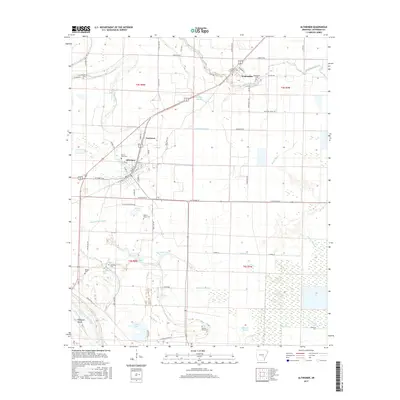
2017 Map of Altheimer
USGS Topo · Published 2017About this map
Altheimer and Wabbaseka anchor this agricultural landscape in Jefferson County, defined by a complex network of bayous and drainage canals that manage the low-lying terrain. The St Louis Southwestern RR cuts diagonally across the northern portion, connecting these small settlements. Local history is deeply etched into the land through numerous family and community burial sites, including Mount Zion Cem, Damascus Cem, and the interestingly named Bloomy Shade Cem to the south.
Find a feature on this map
76 named features on this map. Tap any name to fly to it.
Don’t see what you’re looking for? This feature index may not catch every label — zoom into the map to look around manually.
Map Details
Editions of this 2017 Altheimer Map
This is the sole edition of this map. No revisions or reprints were ever made.
Other maps of this area

1935 · Altheimer
USGS Topo · 1:62,500

1935 · Varner
USGS Topo · 1:62,500

1935 · Noble Lake
USGS Topo · 1:62,500

1941 · Goldman
USGS Topo · 1:62,500

1948 · Helena
USGS Topo · 1:250,000

1950 · Helena
USGS Topo · 1:250,000

1955 · Helena
USGS Topo · 1:250,000

1959 · Helena
USGS Topo · 1:250,000

1960 · Helena
USGS Topo · 1:250,000
1963 · Sherrill
USGS Topo · 1:24,000