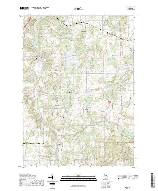
2023 Map of Alto
USGS Topo · Published 2023About this map
Whitneyville and Alaska serve as focal points for this portion of the West Michigan landscape, where the Thornapple River carves a winding path through the western townships. The area is defined by a dense concentration of small glacial lakes, including Campau Lake, Kettle Lake, and Morse Lake, which dot the northern and central sections. This modern survey reflects the transition from early agricultural settlements to a mix of rural residential areas and preserved natural corridors, most notably the North Country National Scenic Trail which traverses the southern border near the Kent and Barry county line.
Find a feature on this map
38 named features on this map. Tap any name to fly to it.
Don’t see what you’re looking for? This feature index may not catch every label — zoom into the map to look around manually.
Map Details
Editions of this 2023 Alto Map
This is the sole edition of this map. No revisions or reprints were ever made.
Other maps of this area

1914 · Grand Rapids
USGS Topo · 1:62,500

1918 · Lowell
USGS Topo · 1:62,500

1943 · Grand Rapids
USGS Topo · 1:62,500

1943 · Lowell
USGS Topo · 1:62,500

1951 · Hastings
USGS Topo · 1:62,500

1958 · Grand Rapids
USGS Topo · 1:250,000

1959 · Wayland
USGS Topo · 1:62,500

1961 · Grand Rapids
USGS Topo · 1:250,000

1962 · Grand Rapids
USGS Topo · 1:250,000
1967 · Grand Rapids East
USGS Topo · 1:24,000
Featured Places
- Cascade Charter Township, MI
- Lowell Charter Township, MI
- Irving Township, MI
- Bowne Township, MI
- Thornapple Township, MI