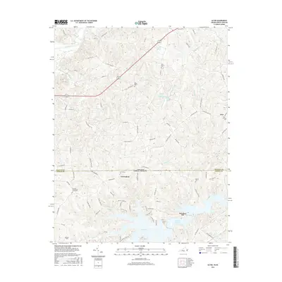
2016 Map of Alton
USGS Topo · Published 2016About this map
Hyco Lake dominates the southern landscape of this border region, its intricate shoreline reaching across the Virginia-North Carolina state line. The map illustrates a rural landscape defined by legacy waterworks and community landmarks, such as McGehees Mill and Wilkins Mill Pond. These features, along with the Dan River in the north, highlight the area's historical reliance on local waterways. Small settlements and crossroads like Cunningham and Alton serve as anchors for the surrounding countryside, which is dotted with numerous family and community burial sites including the Cunningham Cemetery and Olive Branch Cemetery. Long-standing religious institutions like New Bethel Ch and Ephesus Ch further define the social fabric of the border counties, while Holeman Field and Franklin Spring point to more specific land uses and natural resources in this quiet transition zone between the two states.
Find a feature on this map
88 named features on this map. Tap any name to fly to it.
Don’t see what you’re looking for? This feature index may not catch every label — zoom into the map to look around manually.
Map Details
Editions of this 2016 Alton Map
This is the sole edition of this map. No revisions or reprints were ever made.
Other maps of this area

1943 · Roxboro
USGS Topo · 1:62,500

1952 · Milton
USGS Topo · 1:62,500

1953 · South Boston
USGS Topo · 1:62,500

1953 · Greensboro
USGS Topo · 1:250,000

1954 · Greensboro
USGS Topo · 1:250,000

1956 · Milton
USGS Topo · 1:62,500

1957 · South Boston
USGS Topo · 1:62,500

1962 · Greensboro
USGS Topo · 1:250,000

1966 · Greensboro
USGS Topo · 1:250,000

1968 · Leasburg
USGS Topo · 1:24,000