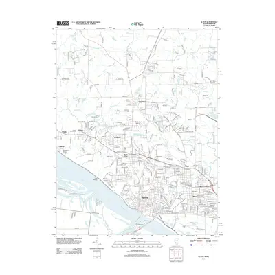
2012 Map of Alton
USGS Topo · Published 2012About this map
The city of Alton anchors this Mississippi River landscape, where industrial history and memorial sites converge along the high bluffs. The riverfront is dominated by significant infrastructure like the Clark Bridge and the Mississippi River itself, which carves a path past Hop Hollow and Quatoga Bluff. This area is particularly notable for its dense concentration of historical burial grounds and commemorative sites, including the Alton National Cem, the Confederate Cem, and the Lovejoy Memorial Cem. Educational institutions such as Lewis and Clark Community College and the Southern Illinois University-Alton Campus indicate the region's shift toward academic and residential centers. Inland from the river, the map shows the expansion of neighborhoods like Upper Alton, Godfrey, and North Alton, separated by small waterways such as Rocky Fork and Coal Br.
Find a feature on this map
269 named features on this map. Tap any name to fly to it.
Don’t see what you’re looking for? This feature index may not catch every label — zoom into the map to look around manually.
Map Details
Editions of this 2012 Alton Map
This is the sole edition of this map. No revisions or reprints were ever made.
Other maps of this area

1925 · Brighton
USGS Topo · 1:62,500

1927 · Alton
USGS Topo · 1:62,500

1927 · St. Charles
USGS Topo · 1:62,500

1928 · Brighton
USGS Topo · 1:62,500

1930 · Jerseyville
USGS Topo · 1:62,500

1933 · Jerseyville
USGS Topo · 1:62,500

1933 · Saint Charles
USGS Topo · 1:62,500

1934 · Alton
USGS Topo · 1:62,500

1935 · Florissant
USGS Topo · 1:24,000

1935 · Columbia Bottom
USGS Topo · 1:24,000