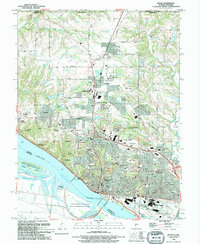
1994 Map of Alton
USGS Topo · Published 1994About this map
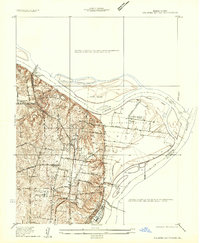
The Mississippi River defines the industrial and geographic character of this riverfront area in the 1990s, where massive engineering projects like the Alton Lock and Dam No 26 and the Clark Bridge facilitate heavy commerce. In Alton, the landscape reflects a deep civic history through sites like the Confederate Cem and National Cem, alongside the Southern Ill Univ (Alton Campus). North of the city, the transition from urban density to the sprawling campus of Lewis and Clark Community College in Godfrey illustrates the regional shift toward educational and residential development. Historical land use is evident in the old railroad grade cutting through the northern hills and the numerous local cemeteries like Bethany Cem and Godfrey Cem that anchor early settlements. Along the river, the Upper Mississippi River State Conservation Area protects the complex network of sloughs and islands, including Dresser Island and Spatterdock Lake.
Find a feature on this map
72 named features on this map. Tap any name to fly to it.
Don’t see what you’re looking for? This feature index may not catch every label — zoom into the map to look around manually.
Map Details
Editions of this 1994 Alton Map
This is the sole edition of this map. No revisions or reprints were ever made.
Other maps of this area
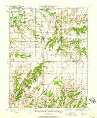
1925 · Brighton
USGS Topo · 1:62,500

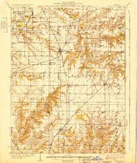
1927 · Alton
USGS Topo · 1:62,500

1927 · St. Charles
USGS Topo · 1:62,500
1928 · Brighton
USGS Topo · 1:62,500

1930 · Jerseyville
USGS Topo · 1:62,500
1933 · Jerseyville
USGS Topo · 1:62,500

1933 · Saint Charles
USGS Topo · 1:62,500

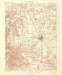
1934 · Alton
USGS Topo · 1:62,500

1935 · Florissant
USGS Topo · 1:24,000
1935 · Columbia Bottom
USGS Topo · 1:24,000