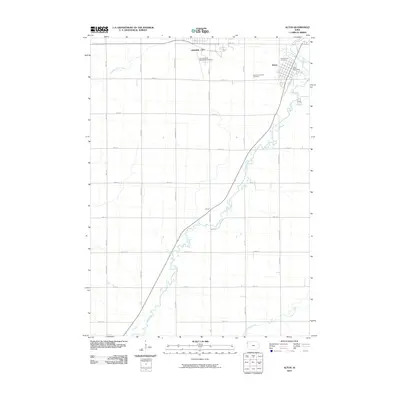
2010 Map of Alton
USGS Topo · Published 2010About this map
Orange City and the nearby town of Alton define the northern portion of this Sioux County landscape, where the Floyd River meanders south through a strictly partitioned grid of section roads. The settlement pattern reflects the agricultural heritage of the region, with the river valley cutting a winding path across the otherwise linear geometry of rural routes like Ibex Ave and 480th St. To the south, the small community of Carnes sits along the river's edge, marking a distinct point of interest for local history researchers.
Find a feature on this map
33 named features on this map. Tap any name to fly to it.
Don’t see what you’re looking for? This feature index may not catch every label — zoom into the map to look around manually.
Map Details
Editions of this 2010 Alton Map
This is the sole edition of this map. No revisions or reprints were ever made.
Other maps of this area

1954 · Fairmont
USGS Topo · 1:250,000

1954 · Fort Dodge
USGS Topo · 1:250,000

1955 · Sioux City
USGS Topo · 1:250,000

1955 · Sioux Falls
USGS Topo · 1:250,000

1957 · Fort Dodge
USGS Topo · 1:250,000

1958 · Sioux City
USGS Topo · 1:250,000

1958 · Sioux Falls
USGS Topo · 1:250,000

1958 · Fort Dodge
USGS Topo · 1:250,000

1958 · Fairmont
USGS Topo · 1:250,000

1959 · Sioux City
USGS Topo · 1:250,000