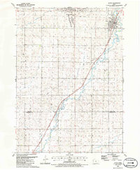
1985 Map of Alton
USGS Topo · Published 1986About this map
Orange City and the neighboring community of Alton anchor this mid-1980s topography of Sioux County, Iowa. The landscape is defined by the winding course of the Floyd River and its floodplain, which cuts a diagonal path through the townships of Nassau and Elgin. Settlement patterns follow the Chicago and North Western rail line, which services the grain-rich agricultural corridor. Cultural landmarks include the campus of Northwestern College and the local High Sch in Orange City, while the small hamlet of Carnes sits further south along the tracks.
Find a feature on this map
26 named features on this map. Tap any name to fly to it.
Don’t see what you’re looking for? This feature index may not catch every label — zoom into the map to look around manually.
Map Details
Editions of this 1985 Alton Map
This is the sole edition of this map. No revisions or reprints were ever made.
Other maps of this area

1954 · Fairmont
USGS Topo · 1:250,000

1954 · Fort Dodge
USGS Topo · 1:250,000

1955 · Sioux City
USGS Topo · 1:250,000

1955 · Sioux Falls
USGS Topo · 1:250,000

1957 · Fort Dodge
USGS Topo · 1:250,000

1958 · Sioux City
USGS Topo · 1:250,000

1958 · Sioux Falls
USGS Topo · 1:250,000

1958 · Fort Dodge
USGS Topo · 1:250,000

1958 · Fairmont
USGS Topo · 1:250,000

1959 · Sioux City
USGS Topo · 1:250,000