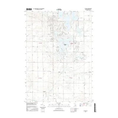
2017 Map of Altona
USGS Topo · Published 2017About this map
The Little Muskegon River meanders through this portion of Mecosta County, defining a landscape where rural township life meets modern recreational developments. The unincorporated community of Altona serves as a central point, surrounded by evidence of early pioneer history in the form of several small burying grounds, including the Altona Cem, Stanwood Cem, and Hinton Cem. To the north, the terrain shifts into the managed resort atmosphere of Canadian Lakes, a sprawling residential and recreational complex featuring E Canadian Lake and W Canadian Lake. This contrast between the traditional grid of township roads, such as 8 Mile Rd and Monroe Rd, and the winding residential drives like Broken Arrow Ln and Golf Port Dr N, illustrates the evolution of land use in the region. Small aviation hubs like Capen Airport and the Canadian Lakes Airport further signify the area's transition into a destination for travel and leisure.
Find a feature on this map
65 named features on this map. Tap any name to fly to it.
Don’t see what you’re looking for? This feature index may not catch every label — zoom into the map to look around manually.
Map Details
Editions of this 2017 Altona Map
This is the sole edition of this map. No revisions or reprints were ever made.
Other maps of this area

1954 · Midland
USGS Topo · 1:250,000

1958 · Midland
USGS Topo · 1:250,000

1958 · Big Rapids
USGS Topo · 1:62,500

1959 · Midland
USGS Topo · 1:250,000

1959 · Howard City
USGS Topo · 1:62,500

1964 · Six Lakes
USGS Topo · 1:24,000

1964 · Mecosta NW
USGS Topo · 1:24,000

1964 · Mecosta
USGS Topo · 1:24,000

1966 · Midland
USGS Topo · 1:250,000

1976 · Big Rapids SE
USGS Topo · 1:24,000