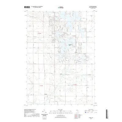
2019 Map of Altona
USGS Topo · Published 2019About this map
The Little Muskegon River meanders through the southern half of this Mecosta County region, anchoring a landscape defined by its glacial lake chains and rural township life. To the north, the recreational community of Canadian Lakes surrounds numerous water bodies including Lake Mecosta, East Canadian Lake, and School Section Lake. This area contrasts with the older, smaller settlements like Altona and Sylvester, where small cemeteries such as Altona Cem and Hinton Cem preserve the genealogy of early Mecosta families. The map reveals a structured grid of rural roads, including 8 Mile Rd and Monroe Rd, which connect scattered homesteads to local hubs and small landing strips like Capen Airport. The presence of several established cemeteries and the confluence of Sylvester Cr with the river offer valuable points of reference for those tracing local history and family lineages.
Find a feature on this map
45 named features on this map. Tap any name to fly to it.
Don’t see what you’re looking for? This feature index may not catch every label — zoom into the map to look around manually.
Map Details
Editions of this 2019 Altona Map
This is the sole edition of this map. No revisions or reprints were ever made.
Other maps of this area

1954 · Midland
USGS Topo · 1:250,000

1958 · Midland
USGS Topo · 1:250,000

1958 · Big Rapids
USGS Topo · 1:62,500

1959 · Midland
USGS Topo · 1:250,000

1959 · Howard City
USGS Topo · 1:62,500

1964 · Six Lakes
USGS Topo · 1:24,000

1964 · Mecosta NW
USGS Topo · 1:24,000

1964 · Mecosta
USGS Topo · 1:24,000

1966 · Midland
USGS Topo · 1:250,000

1976 · Big Rapids SE
USGS Topo · 1:24,000