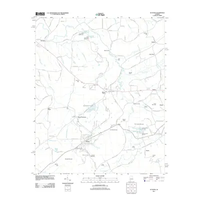
2011 Map of Altoona
USGS Topo · Published 2011About this map
Altoona and Walnut Grove anchor this portion of the Alabama landscape, where the meandering course of the Locust Fork cuts through the ridges of Straight Mountain. This 2011 survey illustrates a region defined by its numerous small-scale reservoirs and mountain gaps, such as Tanyard Gap and Silver Gap, which have historically dictated the flow of local travel. For those researching local history or genealogy, the map reveals several family-named landmarks and resting places, including the Cornelius Cemetery and Bird Cemetery. The distribution of water features, from Whippoorwill Creek to Doctor Jenkins Lake, highlights a rural environment where private and community dams, like the Snead Dam Number One, are central to the terrain's character. Significant local crossings and rural junctions like Ellison Crossroads and Thompson Bridge provide clear evidence of the area's community infrastructure.
Find a feature on this map
148 named features on this map. Tap any name to fly to it.
Don’t see what you’re looking for? This feature index may not catch every label — zoom into the map to look around manually.
Map Details
Editions of this 2011 Altoona Map
This is the sole edition of this map. No revisions or reprints were ever made.
Other maps of this area

1885 · Gadsden
USGS Topo · 1:125,000

1888 · Gadsden
USGS Topo · 1:125,000

1889 · Springville
USGS Topo · 1:125,000

1892 · Springville
USGS Topo · 1:125,000

1892 · Gadsden
USGS Topo · 1:125,000

1895 · Gadsden
USGS Topo · 1:125,000

1903 · Gadsden
USGS Topo · 1:125,000

1936 · Mountainboro
USGS Topo · 1:24,000
1936 · Brooksville
USGS Topo · 1:24,000

1936 · High Point
USGS Topo · 1:24,000