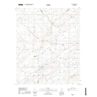
2018 Map of Altoona
USGS Topo · Published 2018About this map
Altoona and its surrounding mountain ridges define the geography of this north Alabama landscape, situated where the borders of Blount, Etowah, and Marshall counties converge. The terrain is characterized by parallel valleys and steep ridgelines, including Sand Mountain to the northwest and the prominent Altoona Mtn and Straight Mtn to the south. Historically significant transport routes and gaps, such as Tanyard Gap and Silver Gap, provide passage between Murphree Valley and Sand Valley. The map records numerous family-named sites and rural landmarks, from Sam Hopper Mtn and Elrod Mtn to water features like Doctor Jenkins Lake and Snead Lake Two. Local heritage is well-preserved through documented cemeteries and gathering places, including the Altoona-Walnut Grove Cem, Cornelius Cem, and Samuels Chapel, reflecting a century of settlement in these narrow corridors of the Appalachian foothills.
Find a feature on this map
155 named features on this map. Tap any name to fly to it.
Don’t see what you’re looking for? This feature index may not catch every label — zoom into the map to look around manually.
Map Details
Editions of this 2018 Altoona Map
This is the sole edition of this map. No revisions or reprints were ever made.
Other maps of this area

1885 · Gadsden
USGS Topo · 1:125,000

1888 · Gadsden
USGS Topo · 1:125,000

1889 · Springville
USGS Topo · 1:125,000

1892 · Springville
USGS Topo · 1:125,000

1892 · Gadsden
USGS Topo · 1:125,000

1895 · Gadsden
USGS Topo · 1:125,000

1903 · Gadsden
USGS Topo · 1:125,000

1936 · Mountainboro
USGS Topo · 1:24,000
1936 · Brooksville
USGS Topo · 1:24,000

1936 · High Point
USGS Topo · 1:24,000