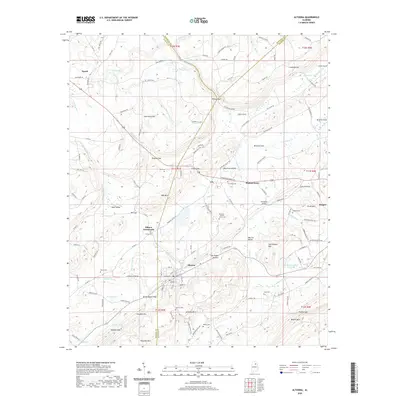
2020 Map of Altoona
USGS Topo · Published 2020About this map
Altoona and Walnut Grove sit at the intersection of industry and topography where the ridges of Sand Mountain meet the valley floors. This 2020 survey documents a landscape defined by its gaps and hollows, such as Tanyard Gap and Van Zandt Hollow, which have historically dictated the path of travel through the Murphree Valley. The area remains dotted with small family and community burial grounds, including the Ellison Cem and the Altoona - Walnut Grove Cem, which serve as vital landmarks for local genealogy and history.
Find a feature on this map
140 named features on this map. Tap any name to fly to it.
Don’t see what you’re looking for? This feature index may not catch every label — zoom into the map to look around manually.
Map Details
Editions of this 2020 Altoona Map
This is the sole edition of this map. No revisions or reprints were ever made.
Other maps of this area

1885 · Gadsden
USGS Topo · 1:125,000

1888 · Gadsden
USGS Topo · 1:125,000

1889 · Springville
USGS Topo · 1:125,000

1892 · Springville
USGS Topo · 1:125,000

1892 · Gadsden
USGS Topo · 1:125,000

1895 · Gadsden
USGS Topo · 1:125,000

1903 · Gadsden
USGS Topo · 1:125,000

1936 · Mountainboro
USGS Topo · 1:24,000
1936 · Brooksville
USGS Topo · 1:24,000

1936 · High Point
USGS Topo · 1:24,000