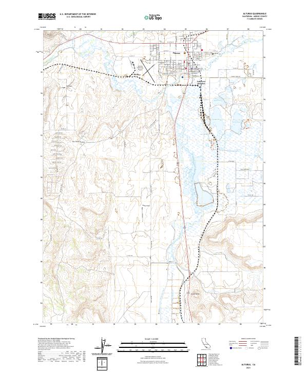
2021 Map of Alturas
USGS Topo · Published 2021About this map
Alturas serves as the focal point of this northeastern California survey, situated at the confluence where the North Fork Pit River and South Fork Pit River meet. The town's grid is well-defined, containing essential civic landmarks including the Modoc County Courthouse, the Robert A Barclay Justice Center, and the nearby Alturas Cem. Outside the immediate town center, the landscape transitions into the extensive wetlands of the Modoc National Wildlife Refuge, which encompasses several named water bodies like Goose Pond and Teal Pond. The surrounding geography is defined by volcanic features and high-desert elevations, with prominent landmarks such as The Three Sisters, The Hat, and Signal Butte rising above the basin. To the south and west, the economy of the land is visible through features like the Westside Canal and Bates Field, while the Alturas Municipal Airport and the community of Juniper mark the edges of the local settlement.
Find a feature on this map
80 named features on this map. Tap any name to fly to it.
Don’t see what you’re looking for? This feature index may not catch every label — zoom into the map to look around manually.
Map Details
Editions of this 2021 Alturas Map
This is the sole edition of this map. No revisions or reprints were ever made.
Other maps of this area

1886 · Alturas
USGS Topo · 1:250,000

1892 · Alturas
USGS Topo · 1:250,000

1954 · Alturas
USGS Topo · 1:250,000

1958 · Alturas
USGS Topo · 1:250,000

1961 · Alturas
USGS Topo · 1:62,500

1962 · Alturas
USGS Topo · 1:250,000

1962 · Davis Creek
USGS Topo · 1:62,500

1962 · Big Sage Reservoir
USGS Topo · 1:62,500

1963 · Little Juniper Reservoir
USGS Topo · 1:24,000

1963 · Dorris Reservoir
USGS Topo · 1:24,000