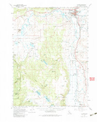
1961 Map of Alturas
USGS Topo · Published 1984About this map
Alturas serves as the hub of this northeastern California landscape, where the confluence of the Pit River and its South Fork shapes the valley floor. The town's infrastructure in the early 1960s includes the Modoc Union High Sch and a Municipal Airport, while the Southern Pacific tracks provide a vital transit link through Lakeview Junc. To the south, the Modoc National Wildlife Refuge preserves the wetlands of the river basin, contrasting with the drier uplands of the Modoc National Forest. The map documents a complex water management system essential for the region's ranching, including Kelly Reservoir, Signal Reservoir, and Graves Reservoir. A significant historical marker, the Infernal Caverns Battleground Memorial Marker, identifies a site of conflict on the southern volcanic plateaus near Rocky Prairie, anchoring the landscape in its 19th-century frontier history.
Find a feature on this map
59 named features on this map. Tap any name to fly to it.
Don’t see what you’re looking for? This feature index may not catch every label — zoom into the map to look around manually.
Map Details
Editions of this 1961 Alturas Map
3 editions found
Other maps of this area

1886 · Alturas
USGS Topo · 1:250,000

1892 · Alturas
USGS Topo · 1:250,000

1954 · Alturas
USGS Topo · 1:250,000

1958 · Alturas
USGS Topo · 1:250,000

1961 · Canby
USGS Topo · 1:62,500

1961 · Alturas
USGS Topo · 1:62,500

1962 · Alturas
USGS Topo · 1:250,000

1962 · Davis Creek
USGS Topo · 1:62,500
1962 · Adin
USGS Topo · 1:62,500

1962 · Tule Mountain
USGS Topo · 1:24,000