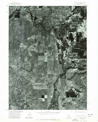
1975 Map of Alturas NE
USGS Topo · Published 1978About this map
Alturas serves as the focal point of this 1970s orthophotograph, situated at the critical confluence where the North Fork Pit River and South Fork Pit River join to form the main stem of the Pit River. This aerial perspective, produced by the Geological Survey in cooperation with the Soil Conservation Service, reveals a landscape defined by the transition from the structured residential grid and commercial center of the town to the vast, complex mosaic of irrigated agricultural fields and wetlands to the south and east. South of the main settlement, the smaller locality of Paola sits along a prominent north-south corridor, surrounded by the intricate drainage patterns and distinct land-use boundaries characteristic of the Modoc plateau. The imagery provides an unfiltered view of the valley's hydrology and land management just before the late 20th century.
Find a feature on this map
5 named features on this map. Tap any name to fly to it.
Don’t see what you’re looking for? This feature index may not catch every label — zoom into the map to look around manually.
Map Details
Editions of this 1975 Alturas NE Map
This is the sole edition of this map. No revisions or reprints were ever made.
Other maps of this area

1886 · Alturas
USGS Topo · 1:250,000

1892 · Alturas
USGS Topo · 1:250,000

1954 · Alturas
USGS Topo · 1:250,000

1958 · Alturas
USGS Topo · 1:250,000

1961 · Alturas
USGS Topo · 1:62,500

1962 · Alturas
USGS Topo · 1:250,000

1962 · Davis Creek
USGS Topo · 1:62,500

1962 · Big Sage Reservoir
USGS Topo · 1:62,500

1963 · Little Juniper Reservoir
USGS Topo · 1:24,000

1963 · Dorris Reservoir
USGS Topo · 1:24,000