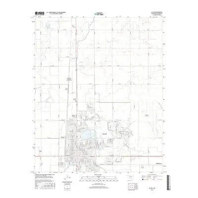
2016 Map of Altus
USGS Topo · Published 2016About this map
Altus stands as a significant hub in Jackson County, characterized by a complex intersection of military, educational, and transportation infrastructure. The vast footprint of Altus Air Force Base dominates the eastern landscape, while Western Oklahoma State Coll anchors the northern residential expansion. Water management is central to the area's development, evidenced by the Altus Reservoir and the drainage patterns of Stinking Cr and Bitter Cr.
Find a feature on this map
39 named features on this map. Tap any name to fly to it.
Don’t see what you’re looking for? This feature index may not catch every label — zoom into the map to look around manually.
Map Details
Editions of this 2016 Altus Map
This is the sole edition of this map. No revisions or reprints were ever made.
Other maps of this area

1955 · Lawton
USGS Topo · 1:250,000

1963 · Altus SE
USGS Topo · 1:24,000

1964 · Martha
USGS Topo · 1:24,000

1964 · Altus
USGS Topo · 1:24,000

1964 · Tipton
USGS Topo · 1:24,000

1964 · Warren
USGS Topo · 1:24,000

1964 · Olustee
USGS Topo · 1:24,000

1964 · Headrick
USGS Topo · 1:24,000

1971 · Blair
USGS Topo · 1:24,000

1971 · Hester
USGS Topo · 1:24,000