
1964 Map of Martha
USGS Topo · Published 1965About this map
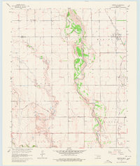
Martha and the rural agricultural lands of Jackson County dominate this mid-1960s survey, defined by the winding course of the Salt Fork Red River. The landscape is a study in southwestern Oklahoma's water-dependent settlement patterns, where the river's Indefinite Boundary and tributaries like Horse Branch shape the local topography. Transportation and infrastructure are anchored by the Missouri Kansas Texas railroad line and the Hollis and Eastern roadway, supporting a community built around small hubs like Victory. For genealogists and local historians, the sheet preserves the locations of vital community landmarks, including the Childrens Home, Mountain View Ch, and both the Martha Cem and Victory Cem. Economic activity is evidenced by several Sandpits along the riverbanks and scattered Oil Wells at the southern edge of the quadrangle.
Find a feature on this map
23 named features on this map. Tap any name to fly to it.
Don’t see what you’re looking for? This feature index may not catch every label — zoom into the map to look around manually.
Map Details
Editions of this 1964 Martha Map
2 editions found
Other maps of this area

1955 · Lawton
USGS Topo · 1:250,000

1963 · Altus SE
USGS Topo · 1:24,000

1964 · Altus
USGS Topo · 1:24,000

1964 · Olustee
USGS Topo · 1:24,000

1971 · Blair
USGS Topo · 1:24,000

1971 · Mangum South
USGS Topo · 1:24,000

1971 · Duke
USGS Topo · 1:24,000

1971 · Prairie Hill
USGS Topo · 1:24,000

1971 · Hester
USGS Topo · 1:24,000

1985 · Altus
USGS Topo · 1:100,000