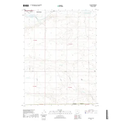
2017 Map of Altvan
USGS Topo · Published 2017About this map
The high plains east of Cheyenne reveal a landscape defined by ranching heritage and water management along the border of Wyoming and Colorado. The influence of the historic Hereford Ranch is prominent here, seen in the infrastructure of the Wyo Hereford Ranch Reservoir Number 1, Wyoming Hereford Ranch Reservoir Number Two, and the extensive Wyoming Hereford Ranch Ditch Number 1. This network of ditches, including Stewart Ditch and Kingman Ditch, illustrates the engineering required to sustain agriculture in this arid environment. The settlement of Altvan sits at the northern edge of the map, while the terrain transitions into natural features like Bull Canyon and Porter Draw. This modern survey records the persistent rural character of Laramie Co as it meets the Colorado state line.
Find a feature on this map
30 named features on this map. Tap any name to fly to it.
Don’t see what you’re looking for? This feature index may not catch every label — zoom into the map to look around manually.
Map Details
Editions of this 2017 Altvan Map
This is the sole edition of this map. No revisions or reprints were ever made.
Other maps of this area

1908 · Eaton
USGS Topo · 1:125,000

1910 · Eaton
USGS Topo · 1:125,000

1911 · Cheyenne
USGS Topo · 1:125,000

1914 · Cheyenne
USGS Topo · 1:125,000

1950 · Cheyenne
USGS Topo · 1:62,500

1954 · Cheyenne
USGS Topo · 1:250,000

1954 · Greeley
USGS Topo · 1:250,000

1957 · Greeley
USGS Topo · 1:250,000

1958 · Cheyenne
USGS Topo · 1:250,000

1958 · Greeley
USGS Topo · 1:250,000