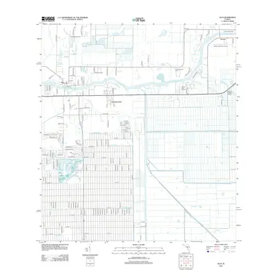
2012 Map of Alva
USGS Topo · Published 2012About this map
The Caloosahatchee River serves as the central artery for this part of Lee County, where the settlement of Alva is established on its northern bank. The landscape is heavily defined by an extensive drainage network, including the West-Baker Canal, George Canal, and Townsend Canal, which reveals the intentional engineering of the Florida interior for agriculture and development. Notable river crossings such as the Fort Denaud Bridge and Banana Branch Bridge connect the residential pockets near Charleston Park and Denaud to the surrounding rural reaches. The map also captures specialized land uses, ranging from the United Methodist Camp to local aviation sites like William's Sky Manor Airport and the Cotton Strip Airport, reflecting the diverse recreational and logistical character of the region in the early 21st century.
Find a feature on this map
138 named features on this map. Tap any name to fly to it.
Don’t see what you’re looking for? This feature index may not catch every label — zoom into the map to look around manually.
Map Details
Editions of this 2012 Alva Map
This is the sole edition of this map. No revisions or reprints were ever made.
Other maps of this area

1956 · Telegraph Swamp
USGS Topo · 1:24,000

1956 · West Palm Beach
USGS Topo · 1:250,000

1957 · West Palm Beach
USGS Topo · 1:250,000

1957 · Telegraph Swamp SE
USGS Topo · 1:24,000

1958 · West Palm Beach
USGS Topo · 1:250,000

1958 · Felda
USGS Topo · 1:24,000

1958 · Olga
USGS Topo · 1:24,000

1958 · Alva SW
USGS Topo · 1:24,000

1958 · Alva
USGS Topo · 1:24,000

1958 · Sears
USGS Topo · 1:24,000