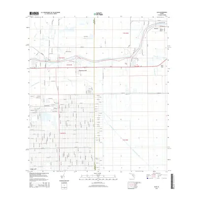
2015 Map of Alva
USGS Topo · Published 2015About this map
The Caloosahatchee River serves as the central artery for this section of southwest Florida, dividing the rural landscape between the settlements of Alva and Denaud. This 2015 perspective illustrates the transition from the riverfront communities to the densely gridded suburban expansion of Lehigh Acres in the southwest. The area's hydraulic history is evident in the intricate network of drainage and transport infrastructure, including the Townsend Canal, Hickey Creek Canal, and King Canal. River crossings are documented via the Fort Denaud Bridge and the Banana Branch Bridge along SR-80. Smaller landmarks like William's Sky Manor Airport and Alma Airport indicate the importance of private aviation in this landscape, while the community of Charleston Park sits just south of the primary river road.
Find a feature on this map
182 named features on this map. Tap any name to fly to it.
Don’t see what you’re looking for? This feature index may not catch every label — zoom into the map to look around manually.
Map Details
Editions of this 2015 Alva Map
This is the sole edition of this map. No revisions or reprints were ever made.
Other maps of this area

1956 · Telegraph Swamp
USGS Topo · 1:24,000

1956 · West Palm Beach
USGS Topo · 1:250,000

1957 · West Palm Beach
USGS Topo · 1:250,000

1957 · Telegraph Swamp SE
USGS Topo · 1:24,000

1958 · West Palm Beach
USGS Topo · 1:250,000

1958 · Felda
USGS Topo · 1:24,000

1958 · Olga
USGS Topo · 1:24,000

1958 · Alva SW
USGS Topo · 1:24,000

1958 · Alva
USGS Topo · 1:24,000

1958 · Sears
USGS Topo · 1:24,000