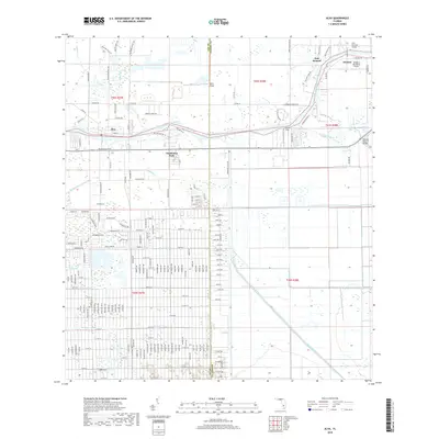
2018 Map of Alva
USGS Topo · Published 2018About this map
The Caloosahatchee River serves as the central artery for this region of Southwest Florida, defining the border between Lee and Hendry counties as it flows past the historic settlement of Alva. This 2018 survey illustrates a landscape of managed water, where an extensive network of drainage and irrigation channels including Hickey Creek Canal, Townsend Canal, and King Canal crisscross the low-lying terrain. The map captures a transition from rural homesteads to more organized residential pockets such as Charleston Park, while maintaining its aviation character through sites like Alma Airport and William's Sky Manor Airport. Downstream, the crossing at Banana Branch Bridge and the vicinity of Fort Denaud highlight long-established transit points along the river's winding path, while named tributaries like Bedman Cr and Cypress Cr drain the surrounding wetlands.
Find a feature on this map
178 named features on this map. Tap any name to fly to it.
Don’t see what you’re looking for? This feature index may not catch every label — zoom into the map to look around manually.
Map Details
Editions of this 2018 Alva Map
This is the sole edition of this map. No revisions or reprints were ever made.
Other maps of this area

1956 · Telegraph Swamp
USGS Topo · 1:24,000

1956 · West Palm Beach
USGS Topo · 1:250,000

1957 · West Palm Beach
USGS Topo · 1:250,000

1957 · Telegraph Swamp SE
USGS Topo · 1:24,000

1958 · West Palm Beach
USGS Topo · 1:250,000

1958 · Felda
USGS Topo · 1:24,000

1958 · Olga
USGS Topo · 1:24,000

1958 · Alva SW
USGS Topo · 1:24,000

1958 · Alva
USGS Topo · 1:24,000

1958 · Sears
USGS Topo · 1:24,000