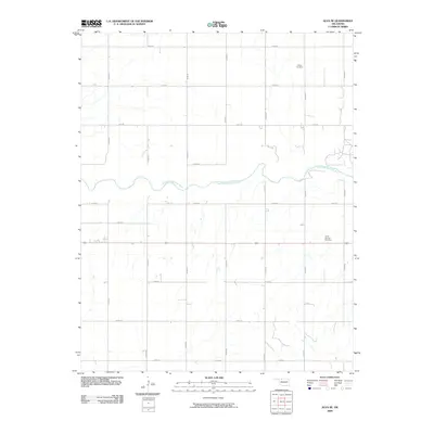
2009 Map of Alva SE
USGS Topo · Published 2009About this map
The Salt Fork Arkansas River meanders across this rural landscape southeast of Alva, carving a path through a grid of section lines in Oklahoma's northern plains. This early twenty-first-century survey illustrates a terrain defined by traditional land divisions and arterial transport, notably the east-west corridor of 64. Local genealogy and community history are anchored by the presence of Liberty Cemetery in the northeast and Short Springs Cemetery further south, providing fixed points of reference for researchers tracing family roots in Woods County. The road network, including routes like E0140 Rd and N2500 Rd, reveals the enduring spatial organization of this agricultural region, where small-scale drainage patterns feed into the primary river system.
Find a feature on this map
20 named features on this map. Tap any name to fly to it.
Don’t see what you’re looking for? This feature index may not catch every label — zoom into the map to look around manually.
Map Details
Editions of this 2009 Alva SE Map
This is the sole edition of this map. No revisions or reprints were ever made.
Other maps of this area

1955 · Woodward
USGS Topo · 1:250,000

1958 · Woodward
USGS Topo · 1:250,000

1968 · Capron
USGS Topo · 1:24,000

1969 · Dacoma
USGS Topo · 1:24,000

1969 · Lambert
USGS Topo · 1:24,000

1969 · Alva SE
USGS Topo · 1:24,000

1969 · Burlington
USGS Topo · 1:24,000

1969 · Hopeton
USGS Topo · 1:24,000

1969 · Alva NW
USGS Topo · 1:24,000

1969 · Ingersoll
USGS Topo · 1:24,000