1969 Map of Lambert
USGS Topo · Published 1971About this map
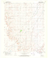
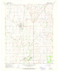
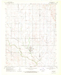
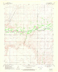
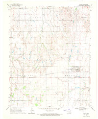
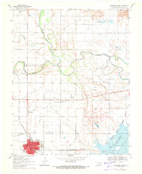
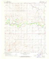
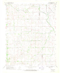
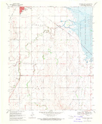
Lambert and the neighboring community of Yewed anchor this Alfalfa County landscape, which is defined by the heavy presence of the Oklahoma rail system in the late 1960s. The territory is bisected by two major routes: the Chicago Rock Island and Pacific and the Atchison Topeka and Santa Fe. These steel arteries supported a rural economy reliant on transportation and extraction, evidenced by several Oil Wells and a Gas Well scattered across the townships of Spring, Lincoln, Eagle Chief, and Clay. Local history and genealogy are preserved at the Auburn Cem in the northwest and Maple Grove Cem in the southeast. The natural drainage of the plains is visible through the winding paths of Cottonwood Creek and West Clay Creek, providing water for the agricultural plots that dominate the terrain between the rail lines.
Find a feature on this map
15 named features on this map. Tap any name to fly to it.
Don’t see what you’re looking for? This feature index may not catch every label — zoom into the map to look around manually.
Map Details
Editions of this 1969 Lambert Map
This is the sole edition of this map. No revisions or reprints were ever made.
Other maps of this area

1955 · Woodward
USGS Topo · 1:250,000

1958 · Woodward
USGS Topo · 1:250,000
1968 · Carmen
USGS Topo · 1:24,000
1969 · Dacoma
USGS Topo · 1:24,000
1969 · Alva SE
USGS Topo · 1:24,000
1969 · Helena
USGS Topo · 1:24,000
1969 · Cherokee North
USGS Topo · 1:24,000
1969 · Ingersoll
USGS Topo · 1:24,000
1969 · Dacoma SE
USGS Topo · 1:24,000
1969 · Cherokee South
USGS Topo · 1:24,000