
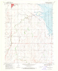
1969 Map of Ingersoll
USGS Topo · Published 1971About this map
Salt Fork Arkansas River dominates this Alfalfa County landscape, winding through a region defined by agricultural townships and the energy industry in the late 1960s. The settlement of Ingersoll serves as a central point where the Chicago Rock Island and Pacific railroad intersects the local infrastructure. The terrain is marked by numerous resource extraction sites, including a Gas Well and Oil Well, signaling the era's industrial activity.
Find a feature on this map
15 named features on this map. Tap any name to fly to it.
Don’t see what you’re looking for? This feature index may not catch every label — zoom into the map to look around manually.
Map Details
Editions of this 1969 Ingersoll Map
This is the sole edition of this map. No revisions or reprints were ever made.
Other maps of this area

1955 · Woodward
USGS Topo · 1:250,000

1958 · Woodward
USGS Topo · 1:250,000

1968 · Capron
USGS Topo · 1:24,000

1969 · Dacoma
USGS Topo · 1:24,000

1969 · Lambert
USGS Topo · 1:24,000

1969 · Alva SE
USGS Topo · 1:24,000

1969 · Amorita
USGS Topo · 1:24,000

1969 · Burlington
USGS Topo · 1:24,000

1969 · Cherokee North
USGS Topo · 1:24,000
1969 · Cherokee South
USGS Topo · 1:24,000