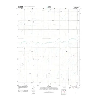
2012 Map of Alva SE
USGS Topo · Published 2012About this map
The Salt Fork Arkansas River carves a winding path across this section of Woods County, defining the local topography and drainage patterns. Historically significant for its roles in regional transit and local irrigation, the river is the primary natural landmark in a landscape otherwise defined by the grid-based settlement typical of the southern Great Plains. Smaller, rural communities such as Brink and Ashley are anchored to the extensive road network, representing the agrarian foundations of the Oklahoma Panhandle region. Local burial sites, including Liberty Cem in the north and Short Springs Cem to the southeast, provide essential points of reference for genealogists tracing families from the early settlement era through the mid-20th century.
Find a feature on this map
24 named features on this map. Tap any name to fly to it.
Don’t see what you’re looking for? This feature index may not catch every label — zoom into the map to look around manually.
Map Details
Editions of this 2012 Alva SE Map
This is the sole edition of this map. No revisions or reprints were ever made.
Other maps of this area

1955 · Woodward
USGS Topo · 1:250,000

1958 · Woodward
USGS Topo · 1:250,000

1968 · Capron
USGS Topo · 1:24,000

1969 · Dacoma
USGS Topo · 1:24,000

1969 · Lambert
USGS Topo · 1:24,000

1969 · Alva SE
USGS Topo · 1:24,000

1969 · Burlington
USGS Topo · 1:24,000

1969 · Hopeton
USGS Topo · 1:24,000

1969 · Alva NW
USGS Topo · 1:24,000

1969 · Ingersoll
USGS Topo · 1:24,000