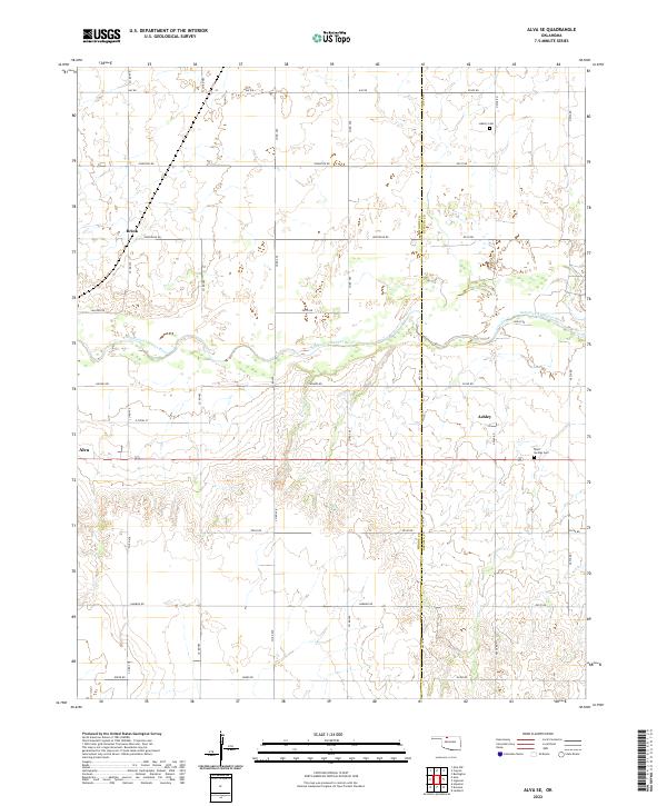
2022 Map of Alva SE
USGS Topo · Published 2022About this map
The Salt Fork Arkansas River meanders across this landscape in Woods Co Alfalfa Co, dividing the northern plains from the complex drainage patterns to the south. The area is defined by its strict section-line road network, including thoroughfares like Hughes Rd and Jefferson Rd, which serve scattered rural settlements. Small communities like Brink and Ashley are situated along these transit lines, reflecting a long-standing agricultural settlement pattern. For genealogists, the map preserves the location of Liberty Cem in the north and Short Springs Cem near the eastern boundary. The western edge captures the periphery of Alva, where the terrain begins to transition from the flat river valley into more dissected topography. This 2022 survey provides a contemporary view of the region's enduring rural character and its established infrastructure of named country roads.
Find a feature on this map
30 named features on this map. Tap any name to fly to it.
Don’t see what you’re looking for? This feature index may not catch every label — zoom into the map to look around manually.
Map Details
Editions of this 2022 Alva SE Map
This is the sole edition of this map. No revisions or reprints were ever made.
Other maps of this area

1955 · Woodward
USGS Topo · 1:250,000

1958 · Woodward
USGS Topo · 1:250,000

1968 · Capron
USGS Topo · 1:24,000

1969 · Dacoma
USGS Topo · 1:24,000

1969 · Lambert
USGS Topo · 1:24,000

1969 · Alva SE
USGS Topo · 1:24,000

1969 · Burlington
USGS Topo · 1:24,000

1969 · Hopeton
USGS Topo · 1:24,000

1969 · Alva NW
USGS Topo · 1:24,000

1969 · Ingersoll
USGS Topo · 1:24,000