
1969 Map of Alva SE
USGS Topo · Published 1971About this map
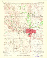
The Salt Fork Arkansas River meanders across this landscape on the boundary between Woods and Alfalfa Counties during the late 1960s. Two major rail corridors define the transportation patterns of the era, with the Atchison Topeka and Santa Fe cutting diagonally through the northwest near Brink and the Chicago Rock Island and Pacific running east-west through Ashley. The presence of several Gas Wells in the southern Valley region indicates the energy extraction footprint of the period. Local heritage is preserved at Liberty Cem and Short Springs Cem, while the broad prairie sections of Driftwood and Keith reflect the region's agricultural character.
Find a feature on this map
15 named features on this map. Tap any name to fly to it.
Don’t see what you’re looking for? This feature index may not catch every label — zoom into the map to look around manually.
Map Details
Editions of this 1969 Alva SE Map
This is the sole edition of this map. No revisions or reprints were ever made.
Other maps of this area

1955 · Woodward
USGS Topo · 1:250,000

1958 · Woodward
USGS Topo · 1:250,000

1968 · Capron
USGS Topo · 1:24,000

1969 · Dacoma
USGS Topo · 1:24,000

1969 · Lambert
USGS Topo · 1:24,000

1969 · Burlington
USGS Topo · 1:24,000

1969 · Hopeton
USGS Topo · 1:24,000

1969 · Alva NW
USGS Topo · 1:24,000

1969 · Ingersoll
USGS Topo · 1:24,000
1969 · Alva
USGS Topo · 1:24,000