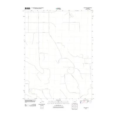
2010 Map of Alvin NW
USGS Topo · Published 2010About this map
The agrarian landscape of Yuma County is defined here by a rigorous section-line grid of rural corridors, including the primary thoroughfare of County Rd-10 along the northern boundary. This territory represents the high plains of eastern Colorado as it appeared in the early 21st century, where the absence of named towns emphasizes a specialized economy of large-scale land management and seasonal water drainages. Movement across the terrain follows established routes like County Rd-49, which cuts diagonally against the standard north-south axis of roads such as County Rd-47. The network of secondary paths, including County Rd MM and County Rd-58, reveals the precise subdivision of property in this corner of the state, providing a clear map for those tracing land ownership and agricultural boundaries in the Alvin NW quadrangle.
Find a feature on this map
21 named features on this map. Tap any name to fly to it.
Don’t see what you’re looking for? This feature index may not catch every label — zoom into the map to look around manually.
Map Details
Editions of this 2010 Alvin NW Map
This is the sole edition of this map. No revisions or reprints were ever made.
Other maps of this area

1954 · Sterling
USGS Topo · 1:250,000

1958 · Sterling
USGS Topo · 1:250,000

1971 · Amherst SW
USGS Topo · 1:24,000

1971 · Holyoke
USGS Topo · 1:24,000

1971 · Alvin NW
USGS Topo · 1:24,000

1971 · Amherst SE
USGS Topo · 1:24,000

1971 · Alvin SW
USGS Topo · 1:24,000

1971 · Wauneta NE
USGS Topo · 1:24,000

1971 · Alvin
USGS Topo · 1:24,000

1971 · Wauneta
USGS Topo · 1:24,000