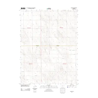
2013 Map of Alvin NW
USGS Topo · Published 2013About this map
Phillips and Yuma counties meet along a surveyed boundary in this High Plains landscape, where the rectangular grid of the Public Land Survey System dictates every movement across the terrain. The map area is defined by an extensive network of rural routes, including the prominent north-south Co Road 49 and Co Road 53, which intersect with east-west thoroughfares like Co Road 6 and Co Road 4. This 2013 survey illustrates the enduring agricultural layout of the region, where roads such as Co Road NN and Co Road HH serve as the primary lifelines between remote farmsteads and section corners. The subtle topography is marked by drainage patterns that cut across the townships of t006n r044w and t005n r043w, reflecting a landscape dedicated to large-scale prairie farming and ranching.
Find a feature on this map
26 named features on this map. Tap any name to fly to it.
Don’t see what you’re looking for? This feature index may not catch every label — zoom into the map to look around manually.
Map Details
Editions of this 2013 Alvin NW Map
This is the sole edition of this map. No revisions or reprints were ever made.
Other maps of this area

1954 · Sterling
USGS Topo · 1:250,000

1958 · Sterling
USGS Topo · 1:250,000

1971 · Amherst SW
USGS Topo · 1:24,000

1971 · Holyoke
USGS Topo · 1:24,000

1971 · Alvin NW
USGS Topo · 1:24,000

1971 · Amherst SE
USGS Topo · 1:24,000

1971 · Alvin SW
USGS Topo · 1:24,000

1971 · Wauneta NE
USGS Topo · 1:24,000

1971 · Alvin
USGS Topo · 1:24,000

1971 · Wauneta
USGS Topo · 1:24,000