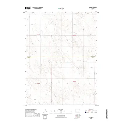
2019 Map of Alvin NW
USGS Topo · Published 2019About this map
The border of Phillips Co Yuma Co divides this rural stretch of the High Plains, revealing a landscape defined by its rigid Public Land Survey System grid. This area, dominated by T6N and T5N, reflects a modern agricultural layout where transportation relies on a network of designated county routes. Significant transit corridors include Co Rd 8, Co Rd 2, and Co Rd 10, which provide the primary access to the open terrain of northeastern Colorado. The map illustrates the sparsely populated nature of the region, where the intersection of roads like Co Rd HH and Co Rd 56 serves as the structural backbone for the local ranching or farming economy. The absence of named settlements highlights the vast, open character of the prairie just before the end of the second decade of the 2000s.
Find a feature on this map
21 named features on this map. Tap any name to fly to it.
Don’t see what you’re looking for? This feature index may not catch every label — zoom into the map to look around manually.
Map Details
Editions of this 2019 Alvin NW Map
This is the sole edition of this map. No revisions or reprints were ever made.
Other maps of this area

1954 · Sterling
USGS Topo · 1:250,000

1958 · Sterling
USGS Topo · 1:250,000

1971 · Amherst SW
USGS Topo · 1:24,000

1971 · Holyoke
USGS Topo · 1:24,000

1971 · Alvin NW
USGS Topo · 1:24,000

1971 · Amherst SE
USGS Topo · 1:24,000

1971 · Alvin SW
USGS Topo · 1:24,000

1971 · Wauneta NE
USGS Topo · 1:24,000

1971 · Alvin
USGS Topo · 1:24,000

1971 · Wauneta
USGS Topo · 1:24,000