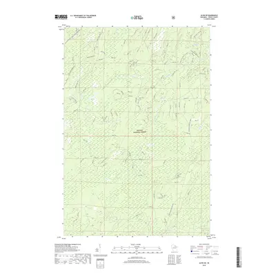
2018 Map of Alvin SW
USGS Topo · Published 2018About this map
The Nicolet National Forest dominates this northern Wisconsin landscape, characterized by a complex network of forest service roads and natural waterways in Forest County. The 2018 survey reveals a terrain managed for both recreation and utility, featuring the Bailey Lake Equestrian area in the northwest and the strategically placed Windsor Dam/Divide Fire Tower overlooking the eastern reaches. The Pine River and its tributaries, including Kimball Cr and McDonald Cr, carve through the timberland. Local nomenclature is reflected in descriptive routes like Sore Back Road, Giant Pine Road, and the Back Tracker Road, which suggest the historic and modern timber operations that have long shaped this part of the Wisconsin Northwoods.
Find a feature on this map
13 named features on this map. Tap any name to fly to it.
Don’t see what you’re looking for? This feature index may not catch every label — zoom into the map to look around manually.
Map Details
Editions of this 2018 Alvin SW Map
This is the sole edition of this map. No revisions or reprints were ever made.
Other maps of this area

1928 · Three Lakes
USGS Topo · 1:48,000

1938 · Alvin
USGS Topo · 1:48,000

1938 · Three Lakes
USGS Topo · 1:48,000

1939 · Crandon
USGS Topo · 1:48,000

1940 · Monico
USGS Topo · 1:48,000

1941 · Crandon
USGS Topo · 1:48,000

1945 · Three Lakes
USGS Topo · 1:48,000

1946 · Alvin
USGS Topo · 1:48,000

1947 · Crandon
USGS Topo · 1:48,000

1950 · Monico
USGS Topo · 1:48,000