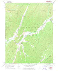
1969 Map of Alvon
USGS Topo · Published 1971About this map
Anthony Creek meanders through the heart of the Monongahela National Forest in this late-1960s survey of Greenbrier County. The landscape is defined by its deep valley hollows and the towering ridges of Slabcamp Mountain and Beaver Lick Mountain. The small settlement of Alvon serves as a local hub near Fleming Run, while further north, the Anthony Correctional Center and the community of Neola sit near the confluence of Meadow Cr and the main creek.
Find a feature on this map
55 named features on this map. Tap any name to fly to it.
Don’t see what you’re looking for? This feature index may not catch every label — zoom into the map to look around manually.
Map Details
Editions of this 1969 Alvon Map
3 editions found
Other maps of this area

1887 · Lewisburg
USGS Topo · 1:125,000

1891 · Lewisburg
USGS Topo · 1:125,000

1891 · Huntersville
USGS Topo · 1:125,000

1894 · Huntersville
USGS Topo · 1:125,000

1921 · Callaghan
USGS Topo · 1:48,000

1921 · White Sulphur Springs
USGS Topo · 1:48,000

1923 · Lobelia
USGS Topo · 1:48,000

1923 · White Sulphur Springs
USGS Topo · 1:62,500

1923 · Marlinton
USGS Topo · 1:48,000

1923 · Callaghan
USGS Topo · 1:62,500