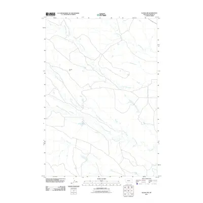
2011 Map of Alzada NW
USGS Topo · Published 2011About this map
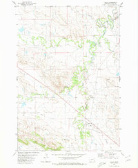
Arbuckle Dam sits at the heart of this high-plains landscape in Carter County, anchoring a drainage network defined by the seasonal flow of many tributary systems. The terrain is intricately etched by the branching paths of North Cottonwood Creek and South Cottonwood Creek as they move toward their confluence, while the northern reaches are dominated by the parallel courses of North Butte Creek and South Butte Creek. This 2011 survey captures the remote rangeland character of southeastern Montana, showing a topography where water management and natural hydrology dictate the placement of local roads and land use. Minor watercourses like Hamilton Creek and Short Creek further illustrate the complex watershed that characterizes this corner of the state, providing a clear record of the area's physical geography in the early twenty-first century.
Find a feature on this map
8 named features on this map. Tap any name to fly to it.
Don’t see what you’re looking for? This feature index may not catch every label — zoom into the map to look around manually.
Map Details
Editions of this 2011 Alzada NW Map
This is the sole edition of this map. No revisions or reprints were ever made.
Other maps of this area

1954 · Ekalaka
USGS Topo · 1:250,000

1956 · Ekalaka
USGS Topo · 1:250,000

1958 · Ekalaka
USGS Topo · 1:250,000

1965 · Ekalaka
USGS Topo · 1:250,000
1980 · Alzada NW
USGS Topo · 1:24,000

1980 · Finger Buttes East
USGS Topo · 1:24,000
1980 · Sevenmile Creek
USGS Topo · 1:24,000
1980 · Albion
USGS Topo · 1:24,000
1980 · Alzada
USGS Topo · 1:24,000
1980 · Finger Buttes West
USGS Topo · 1:24,000