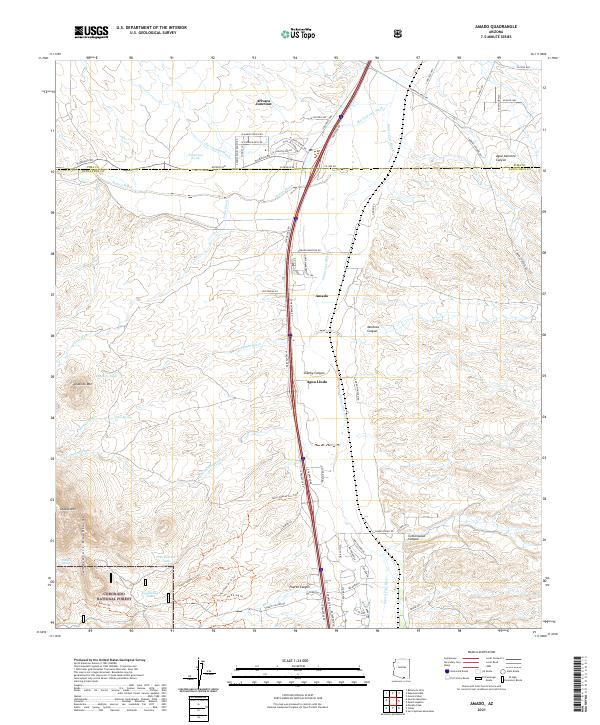
2021 Map of Amado
USGS Topo · Published 2021About this map
The Santa Cruz River valley serves as the central corridor for this part of southern Arizona, where the communities of Amado, Arivaca Junction, and Agua Linda follow the primary transportation route. The landscape is defined by its arid drainage systems, with Old Junction Wash, Sopori Wash, and Las Chivas Wash cutting through the terrain. To the west, the foothills of the Tumacacori Mountains rise sharply, anchored by prominent peaks like Diablo Mtn and Diablito Mtn. Ranching and land management are evident through the numerous water features such as Patterson Tank and Doodlebug Tank, alongside the protected acreage of the Coronado National Forest and Game Management Unit 34A. Vital water sources for local use are marked by several springs, including Diablito Spring, Toros Spring, and Puerto Spring, which reflect the historical importance of water access in this high desert environment.
Find a feature on this map
75 named features on this map. Tap any name to fly to it.
Don’t see what you’re looking for? This feature index may not catch every label — zoom into the map to look around manually.
Map Details
Editions of this 2021 Amado Map
This is the sole edition of this map. No revisions or reprints were ever made.
Other maps of this area

1904 · Patagonia
USGS Topo · 1:125,000

1905 · Patagonia
USGS Topo · 1:125,000

1920 · Arivaca
USGS Topo · 1:125,000

1922 · Agus Caliente
USGS Topo · 1:62,500

1925 · Samaniego Peak
USGS Topo · 1:62,500

1926 · Helvetia
USGS Topo · 1:62,500

1939 · Twin Buttes
USGS Topo · 1:62,500

1939 · Tubac
USGS Topo · 1:62,500

1941 · Twin Buttes
USGS Topo · 1:62,500

1943 · Tubac
USGS Topo · 1:62,500