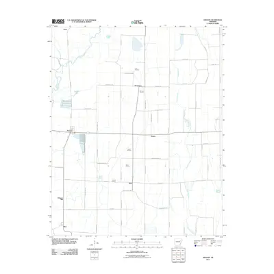
2011 Map of Amagon
USGS Topo · Published 2011About this map
Cache River and its meandering tributaries dominate the western edge of this Jackson County landscape, where the flat alluvial plains of northeastern Arkansas are carved into a geometric grid of rural roads. The town of Amagon sits as a central hub at a key intersection, surrounded by a network of smaller named settlements including Pennington, Balch, and Algoa. This 2011 survey reveals a landscape deeply connected to its agricultural and water-management history, evidenced by the numerous sloughs and creeks such as Mink Slough and Snake Slough that drain the eastern acreage.
Find a feature on this map
55 named features on this map. Tap any name to fly to it.
Don’t see what you’re looking for? This feature index may not catch every label — zoom into the map to look around manually.
Map Details
Editions of this 2011 Amagon Map
This is the sole edition of this map. No revisions or reprints were ever made.
Other maps of this area

1935 · Tuckerman
USGS Topo · 1:62,500

1939 · Vanndale
USGS Topo · 1:62,500

1939 · Weiner
USGS Topo · 1:62,500

1940 · Tilton
USGS Topo · 1:62,500

1953 · Memphis
USGS Topo · 1:250,000

1956 · Memphis
USGS Topo · 1:250,000

1956 · Tilton
USGS Topo · 1:62,500

1958 · Vanndale
USGS Topo · 1:62,500

1959 · Weiner
USGS Topo · 1:62,500

1960 · Weiner
USGS Topo · 1:62,500